© Zell am See-Kaprun Tourismus GmbH - Zell am See-Kaprun Tourismus

- Breve descripción
-
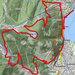
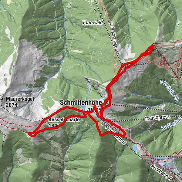
The Schmitten Trail Run, with start and finish at the trassXpress upper terminus, is pure trail running pleasure and leads over the high-altitude promenade between Schmittenhöhe, Sonnkogel, Breiteckalm and Pinzgauerhütte.
- Dificultad
-
difícil
- Valoración
-
- Ruta
-
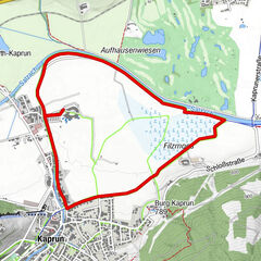
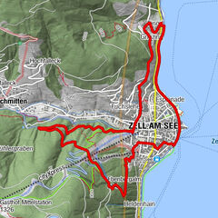
Schmittenhöhe (1.965 m)0,5 kmHochzeller-Alm0,8 kmSonnkogel Alm2,9 kmSalersbachköpfl (1.934 m)3,9 kmHochzeller-Alm4,9 kmSchmittenhöhe (1.965 m)5,3 kmElisabeth-Kapelle5,3 kmBreiteckalm6,7 kmEderhütte8,4 kmKettingtörl (1.780 m)8,5 kmPinzgauer Hütte9,6 kmKesselscharte (1.847 m)11,1 kmKettingkopf (1.865 m)11,8 kmKettingtörl (1.780 m)12,4 kmEderhütte12,4 km
- La mejor temporada
-
enefebmarabrmayjunjulagosepoctnovdic
- Punto álgido
- 1.953 m
- Punto final
-
mountain station trassXpress
- Perfil alto
-

-

-
AutorLa gira Panorama Trail long es utilizado por outdooractive.com proporcionado.
GPS Downloads


Información general
Punto de avituallamiento
Más circuitos por las regiones