Datos del tour
16,33km
538
- 1.487m
848hm
848hm
03:40h
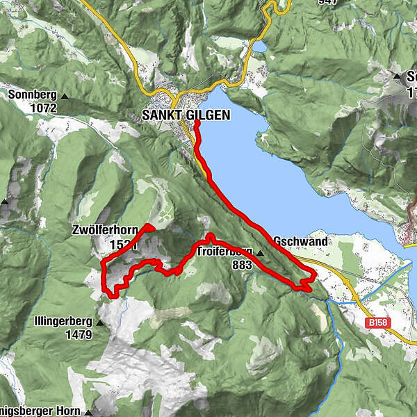
- Dificultad
-
medio
- Valoración
-
- Punto de salida
-
Gasthof Gamsjaga
- Ruta
-
Sankt GilgenLueg1,3 kmFranzosenschanze3,0 kmSeegasthof Gamsjaga4,1 kmGschwand4,5 kmBrunn5,1 kmBraunauer Hütte12,3 kmIllingeralm12,5 kmPillsteinhöhe (1.478 m)14,4 kmArnikahütte15,6 kmVoit'l Hütte am Zwölferhorn15,9 kmDas Zwölfer16,1 kmZwölferhorn (1.521 m)16,3 km
- La mejor temporada
-
enefebmarabrmayjunjulagosepoctnovdic
- Punto álgido
- 1.487 m
- Descanso/Avituallamiento
-
Illingeralm. Annikahütte
GPS Downloads


Calzadas
Asfalto
Gravilla
Bosque
Caminos de montaña
Rutas individuales
Trial
Tráfico
Más circuitos por las regiones