© Christoph Sonderegger - St.Gallen-Bodensee Tourismus

© Roland Gerth - St.Gallen-Bodensee Tourismus
- Breve descripción
-
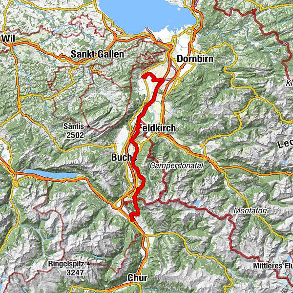
In just three days by bike right across the entire Principality of Liechtenstein and the Rhine Valley.
- Dificultad
-
medio
- Valoración
-
- Ruta
-
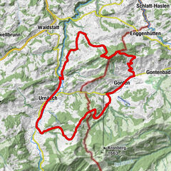
AltstättenAltstätten (430 m)0,9 kmKriessern7,8 kmMontlingen13,7 kmBüchel (426 m)21,3 kmRuggell (433 m)28,0 kmGamprin (472 m)30,9 kmBendern32,3 kmFriedhofskapelle St. Johannes38,5 kmSchaan (450 m)38,9 kmMühleholz40,0 kmEbenholz40,7 kmKänzile42,9 kmVaduz (455 m)43,2 kmTriesenberg (884 m)47,2 kmPfarrkirche Sankt Josef47,3 kmSteinort48,5 kmBalzers (477 m)57,4 kmKaserne Sankt Luzisteig63,0 kmRestaurant Panorama63,0 kmSankt Luzisteig63,9 kmSankt Luzisteig (713m)63,9 kmSteigkirche63,9 kmGasthof St. Luzisteig63,9 kmFläsch (528 m)66,3 kmBad Ragaz (502 m)69,2 km
- La mejor temporada
-
enefebmarabrmayjunjulagosepoctnovdic
- Punto álgido
- 986 m
- Punto final
-
Bad Ragaz
- Perfil alto
-
 © outdooractive.com
- Autor
-
La gira 2-Country Bike es utilizado por outdooractive.com proporcionado.
GPS Downloads


Información general
Punto de avituallamiento
Cultural/Histórico
Vistas panorámicas
Más circuitos por las regiones
-
Appenzellerland
154
-
Liechtenstein
129
-
Eschen-Nendeln
27

")