Weißes Kreuz Circular Trail

Logotipo Weißes Kreuz Circular Trail
Datos del tour
13,44km
460 - 956m
Distancia
537hm
534hm
Ascenso
04:18h
 
Duración
Breve descripción

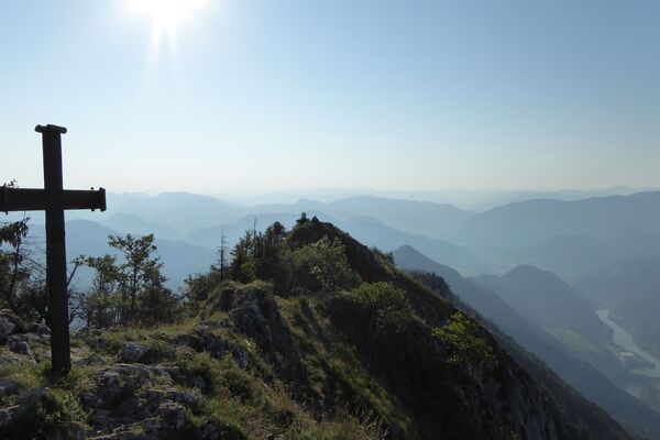
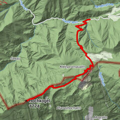
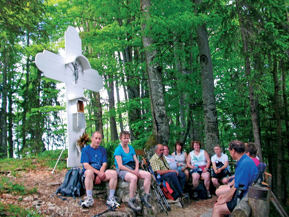
Summit tour starting from Gaflenz/Oberland and returning via Kleingschnaidt

Dificultad
medio
Valoración
Técnica
Nivel
Paisaje
Experiencias
Ruta
Oberland
Am Thall
5,1 km
Pfandlwirt
11,0 km
Gaflenz
11,0 km
Oberland
13,3 km

La mejor temporada
ene
feb
mar
abr
may
jun
jul
ago
sep
oct
nov
dic
Punto álgido
956 m
Punto final

Gaflenz/Oberland

Perfil alto

Autor
La gira Weißes Kreuz Circular Trail es utilizado por outdooractive.com proporcionado.

Valoración global

5

0

%

4

0

%

3

0

%

2

0

%

1

0

%

Error
Se ha producido un error. Por favor, inténtelo de nuevo.
Gracias por su comentario

Se ha eliminado la calificación

GPS Downloads
  • GPX GPS Exchange Format (XML)
  • KML Google Earth, Google Maps
Códigos de descarga QR para teléfonos móviles
Más circuitos por las regiones

Excursiones opcionales por los alrededores

Schieferstein via Reichraming

medio Senderismo
7,03km | 804hm | 02:45h

Gamsstein-Tour

medio Senderismo
15,37km | 1056hm | 06:00h

Hochkogel, Randegg, NÖ

fácil Senderismo
11,17km | 335hm | 03:00h

Gschwendtalm - Gamsstein (von Brunnbach)

medio Senderismo
6,8km | 731hm | 02:39h