Datos del tour
15,6km
254
- 454m
250hm
04:30h
- Breve descripción
-
Rundwanderweg
- Valoración
-
- Punto de salida
-
Fähre Ottensheim
- Ruta
-
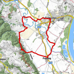
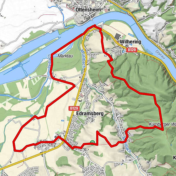
OttensheimWilhering Ufer0,0 kmRosenfeldweg0,6 kmHöf0,8 kmGasthof Leitner (Closed)5,6 kmEdramsberg6,7 kmWinkeln7,5 kmSchönering8,5 kmCafe Restaurant Regina8,7 kmGasthof Herzog-Übleis8,7 kmGasthof Hollaus10,6 kmFall13,4 kmWilhering Ufer15,4 kmOttensheim15,5 km
- Punto álgido
- 454 m
- Descanso/Avituallamiento
-
Gasthaus "Bründl im Fall", Fall
Cafe-Restaurant Regina, Schönering
Gasthaus Hollaus, Schönering
Asia-Restaurant "Chidori", Schönering
GPS Downloads


Superficie de carretera
Asfalto
Gravilla
Pradera
Bosque
Roca
Expuesto
Más circuitos por las regiones
-
Mühlviertel
1781
-
Donau Oberösterreich
775
-
Wilhering
303