St. Agatha: “Es muss sein” (“It has to be”) Trail

Senderismo

© WGD Donau Oberösterreich Tourismus GmbH/Weissenbrunner - Weissenbrunner

© WGD Donau Oberösterreich Tourismus GmbH/Weissenbrunner - Weissenbrunner


- Breve descripción
-
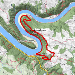
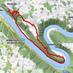
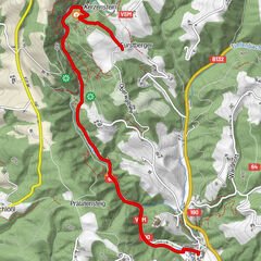
Hiking trail offering fantastic views of the Mühlviertel district, the foothills of the Alps and the Schlögen Danube Loop.
- Dificultad
-
medio
- Valoración
-
- Ruta
-
St. Agatha (603 m)Scharzeredt0,7 kmEtzing (615 m)1,7 kmBräuleiten3,0 kmMitterberg5,0 kmHauskapelle Hotel Donauschlinge5,8 kmSchlögen5,8 kmSchlögener Blick7,3 kmSchlögenleiten7,8 kmLinetshub8,4 kmDorf11,0 kmHaibach ob der Donau11,3 kmDonauleiten12,6 kmWiesing13,9 kmDunzing (536 m)17,4 kmMiniwirt19,4 kmSt. Agatha (603 m)20,5 km
- La mejor temporada
-
enefebmarabrmayjunjulagosepoctnovdic
- Punto álgido
- 625 m
- Punto final
-
Ortszentrum St. Agatha
- Perfil alto
-


- Autor
-
La gira St. Agatha: “Es muss sein” (“It has to be”) Trail es utilizado por outdooractive.com proporcionado.
GPS Downloads


Información general
Punto de avituallamiento
Vistas panorámicas
Más circuitos por las regiones