
© Pixabay

- Breve descripción
-
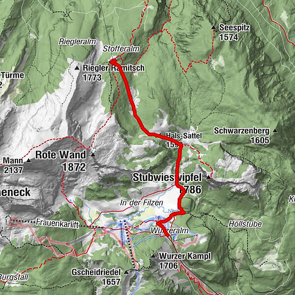
Von der Bergstation Wurzeralm geht es mit mäßiger Steigung zur Dümlerhütte.
- Dificultad
-
fácil
- Valoración
-
- Ruta
-
Wiederlechnerhütte0,0 kmBergrestaurant Wurzeralm0,1 kmLinzer Haus / Wurzeralm0,2 kmHals-Sattel (1.599 m)2,5 kmDümlerhütte4,3 km
- Punto álgido
- 1.578 m
- Punto final
-
Dümlerhütte
- Perfil alto
-

- Autor
-
La gira Von der Wurzeralm zur Dümlerhütte es utilizado por outdooractive.com proporcionado.
GPS Downloads


Más circuitos por las regiones
-
Gesäuse
2225
-
Urlaubsregion Pyhrn - Priel
1440
-
Spital am Pyhrn - Wurzeralm
434


")


