© POV

© POV

© POV

© POV

- Breve descripción
-
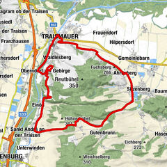
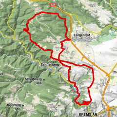
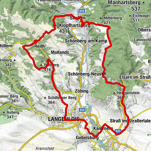
Langenlois - Straß - Stiefern - Oberreith - Rotes Kreuz - Unterreith - Fahnberg - Bockshörndl - Langenlois
- Dificultad
-
medio
- Valoración
-
- Ruta
-
LangenloisEuropapark0,8 kmGobelsburg2,4 kmFilialkirche hl. Maria Magdalena3,7 kmKammern3,8 kmPfarrkirche „Maria Himmelfahrt“ Strass im Strassertal6,4 kmStraß im Straßertale6,4 kmKalvarienberg (309 m)16,8 kmGasthof Haimerl17,8 kmStiefern18,1 kmPfarrkirche hl. Johannes der Täufer18,2 kmKlopfhartsberg (431 m)20,5 kmSchmalzberg (419 m)21,4 kmOberreith22,7 kmReith22,9 kmUnterreith27,2 kmLangenlois31,8 km
- La mejor temporada
-
enefebmarabrmayjunjulagosepoctnovdic
- Punto álgido
- 424 m
- Punto final
-
Langenlois, Kornplatz
- Perfil alto
-


- Autor
-
La gira Zweigelt-Strecke es utilizado por outdooractive.com proporcionado.
GPS Downloads


Información general
Punto de avituallamiento
Secreto
Más circuitos por las regiones