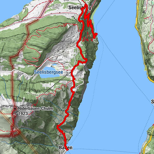
The Swiss Path – Section 1: Seelisberg, Rütli - Bauen

Senderismo
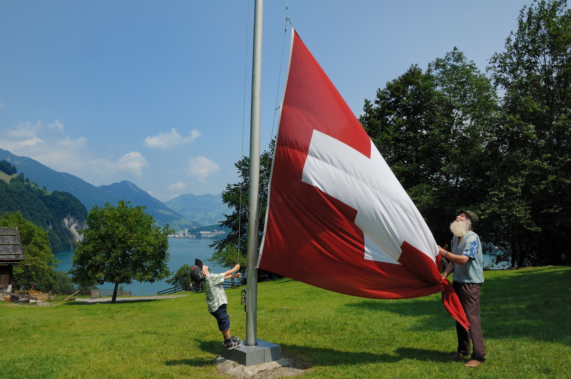
© Wiege der Schweiz - Outsideisfree
© Wiege der Schweiz - Erlebnisregion Mythen
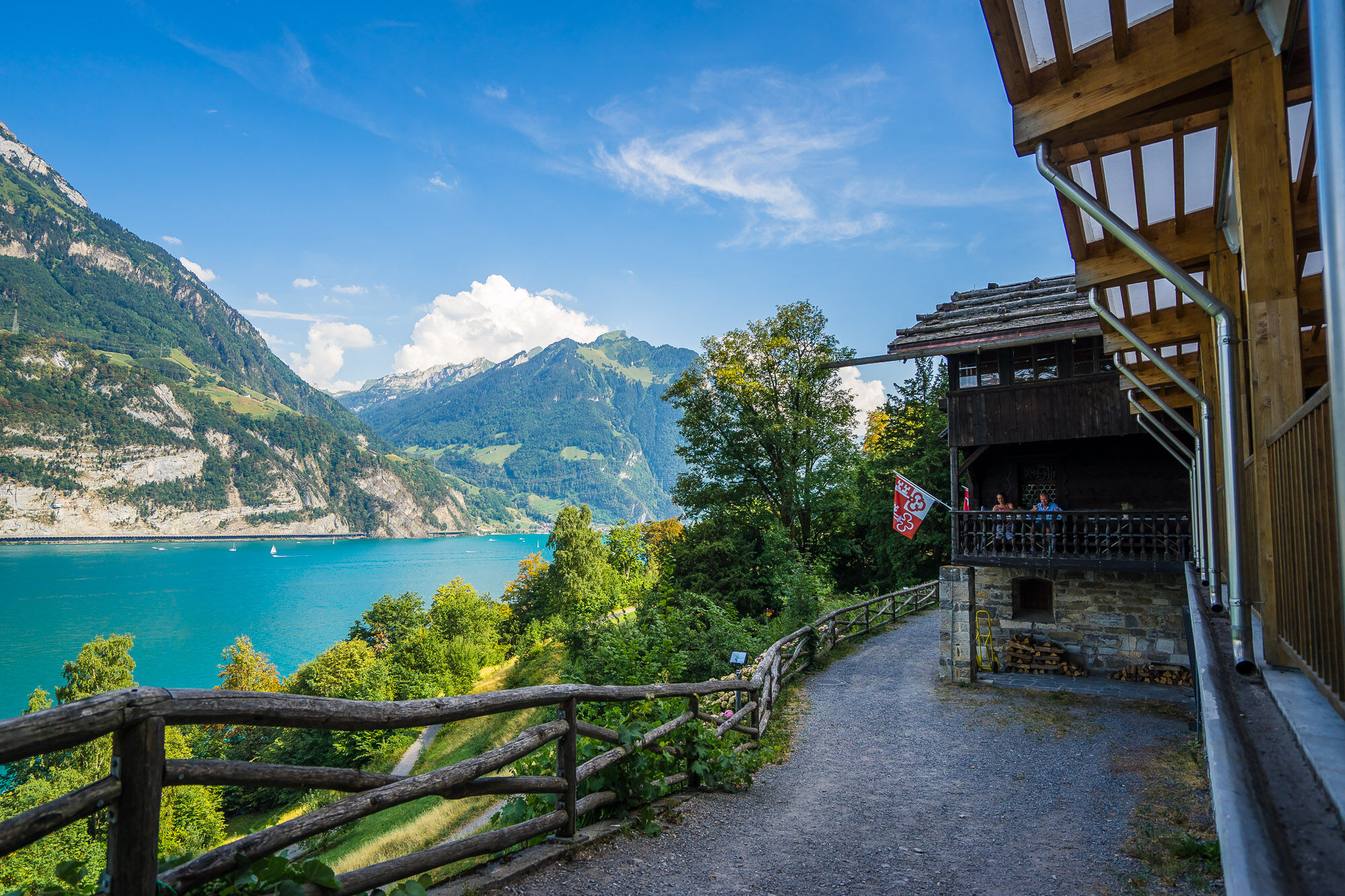
© Wiege der Schweiz - Outsideisfree

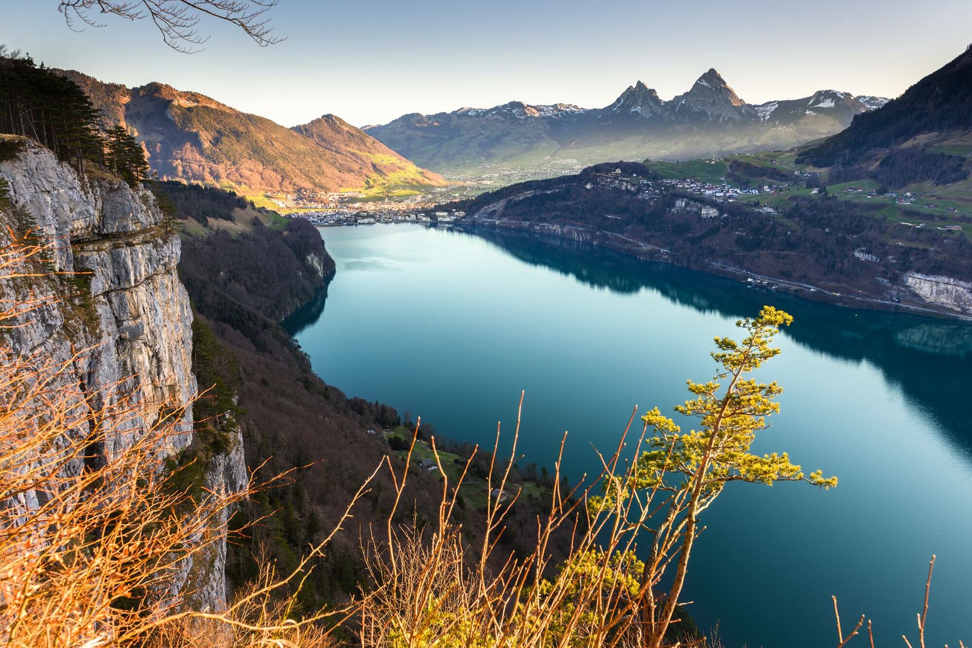
© Wiege der Schweiz - Sascha Krähenbühl

- Breve descripción
-
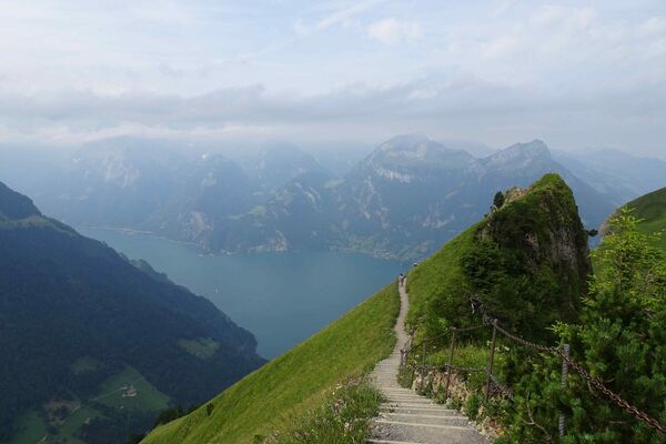
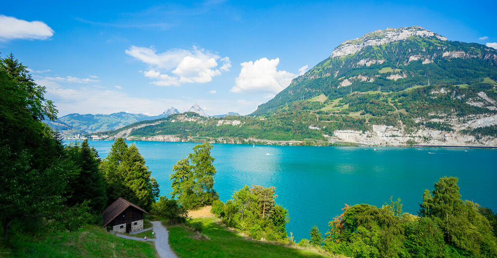
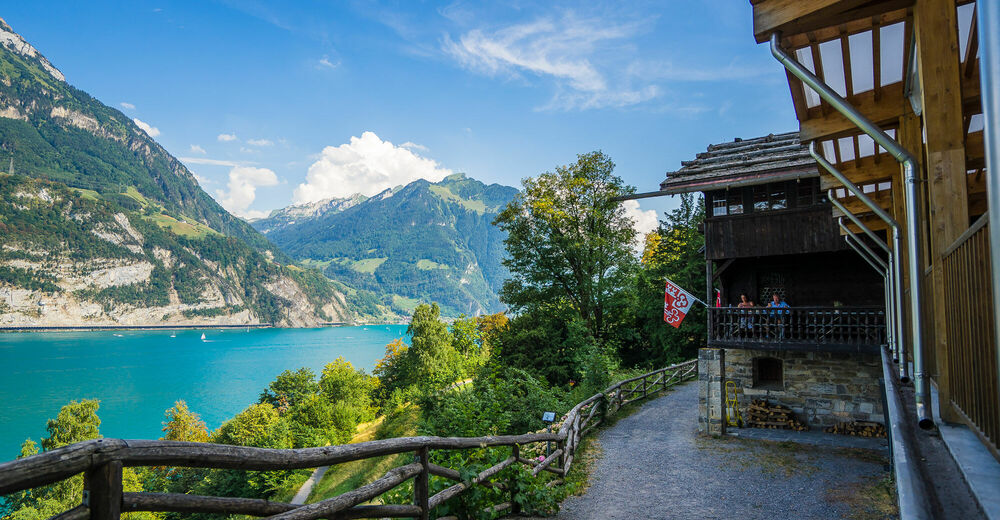
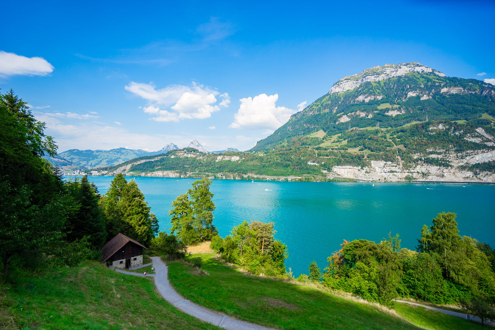
Snakes up through the forest to Seelisberg. Walkers are rewarded with a unique lake and mountain view. Historic paths lead past viewing platforms to Beroldingen Castle and then 960 steps down to Bauen.
- Dificultad
-
medio
- Valoración
-
- Ruta
-
Rütli (435 m)Rütli0,2 kmRütlihaus0,2 kmStöck2,3 kmBuechigstud2,4 kmBreitlohn2,6 kmFurli2,8 kmSeelisberg (801 m)2,8 kmRestaurant Bahnhof2,8 kmSt. Michael3,1 kmSeelisberg3,2 kmSchillerbalkon3,7 kmWallfahrtskapelle Maria Sonnenberg3,9 kmSeelisberg (Oberdorf)4,1 kmTräumli4,4 kmAlte Post9,1 kmZwyssighaus9,1 kmHofstatt9,1 kmKath. Kirche St. Ida9,2 kmFischli am See9,2 kmStützli9,3 kmSchiller Hotel9,3 kmBauen (436 m)9,3 kmIm Dorf9,3 kmBauen (See) (435 m)9,3 km
- La mejor temporada
-
enefebmarabrmayjunjulagosepoctnovdic
- Punto álgido
- 864 m
- Punto final
-
Bauen
- Perfil alto
-
 © outdooractive.com
- Autor
-
La gira The Swiss Path – Section 1: Seelisberg, Rütli - Bauen es utilizado por outdooractive.com proporcionado.
GPS Downloads
Información general
Punto de avituallamiento
Cultural/Histórico
Vistas panorámicas
Más circuitos por las regiones
-
Schwyz
1747
-
Klewenalp-Vierwaldstaettersee
965
-
Seelisberg
429