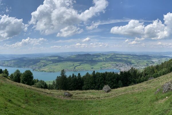
© Region Luzern-Vierwaldstättersee - Carla Hendry

© Region Luzern-Vierwaldstättersee - Carla Hendry

© Region Luzern-Vierwaldstättersee - Carla Hendry

- Breve descripción
-
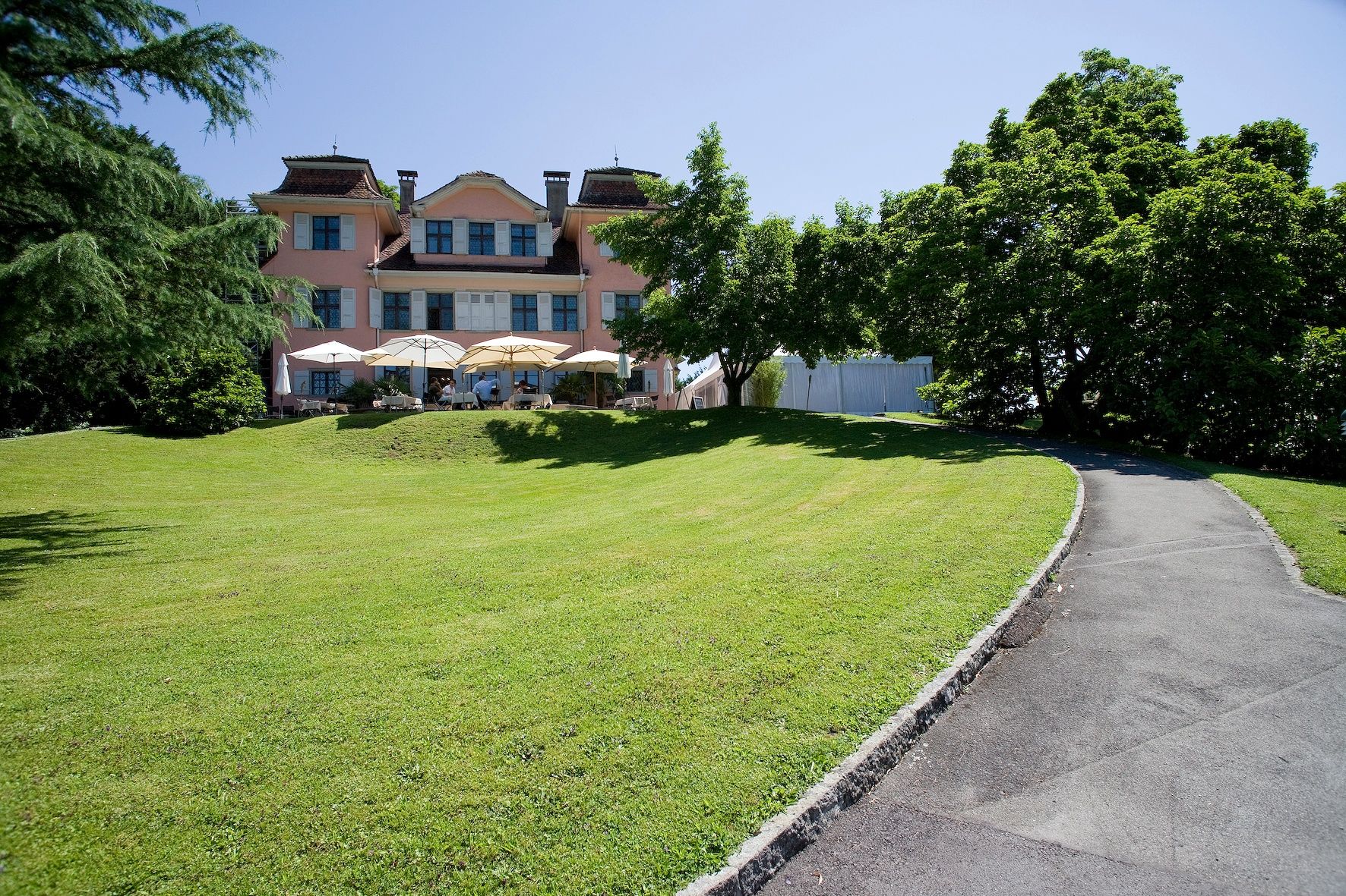
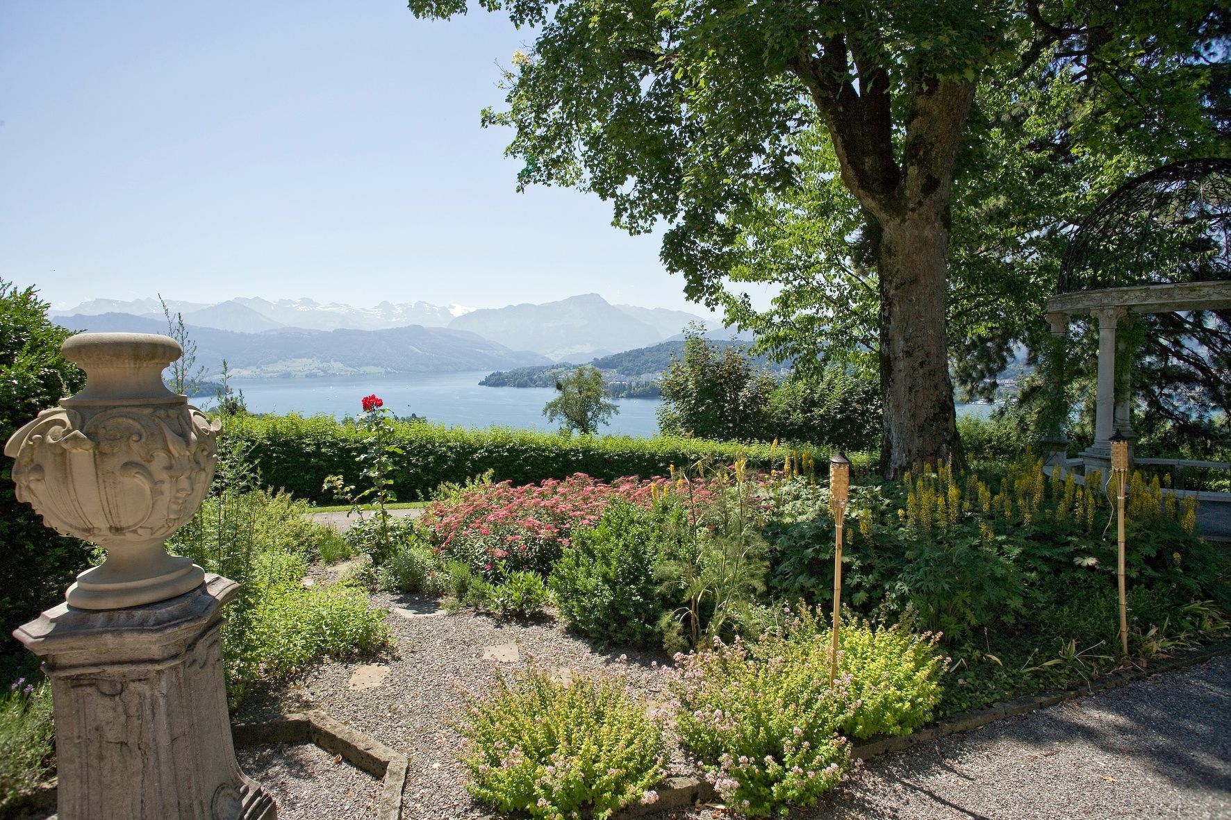
From the centre of Meggen, you climb through fields and meadows to mystical Megger forest before continuing on to Adligenswil. High above the town, you pass the Kurhaus Sonnmatt to reach Gerlisberg monastery. After a final effort you arrive at the Dietschiberg, little sister of the Rigi. You then descend to the Utenberg before entering the huge Dreilinden Park.
- Dificultad
-
fácil
- Valoración
-
- Ruta
-
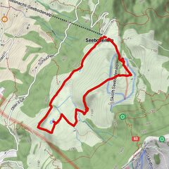
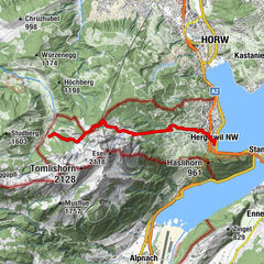
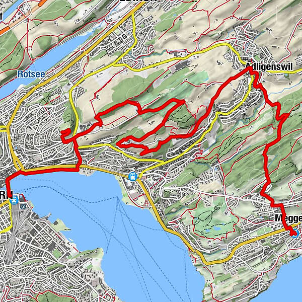
Meggen Zentrum (470 m)0,0 kmMeggen0,2 kmSchlössli0,2 kmPiuskirche0,3 kmAdligenswil4,2 kmSt. Martin4,2 kmObgardi4,5 kmSchlössli7,0 kmDietschiberg10,2 kmKonservatorium12,7 kmEingang "Schiffrestaurant Wilhelm Tell"14,2 kmBrücke 814,7 kmLuzern Schweizerhofquai (435 m)14,8 kmLucerna (436 m)15,3 km
- La mejor temporada
-
enefebmarabrmayjunjulagosepoctnovdic
- Punto álgido
- 650 m
- Punto final
-
Lucerne railway station
- Perfil alto
-
 © outdooractive.com

-

-
AutorLa gira Via Meggen to the Dietschiberg es utilizado por outdooractive.com proporcionado.
GPS Downloads


Información general
Punto de avituallamiento
Cultural/Histórico
Vistas panorámicas
Más circuitos por las regiones
-
Luzern und Umgebung
1711
-
Weggis Vitznau Rigi
891
-
Ebikon
196