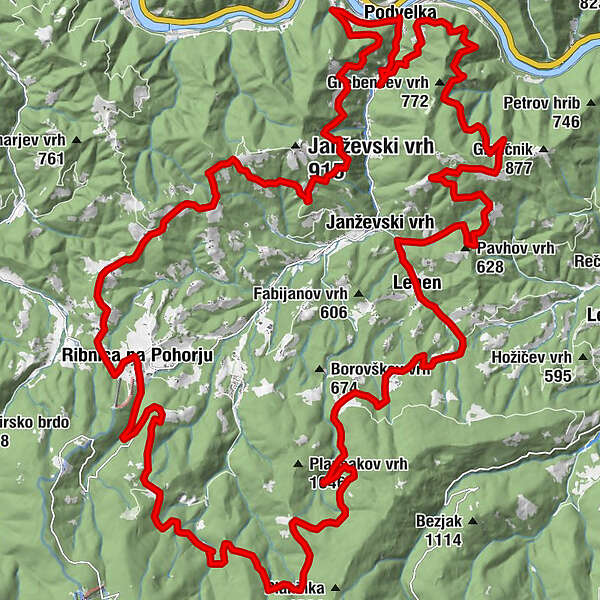
Rund ums Velka, um den Fluss Velka herum

Mountainbike

© Südsteiermark - Monika Kapun
- Breve descripción
-
Strecke
55 km
Fahrtzeit ca. 4,5 Stunden
Höhenmeter 1720 m
Schwierigkeit Schwer
Kondition *****
Panorama *****
Beste Jahreszeit März-Oktober
Strecke ca. 27 % Asphalt, 70 % Schotter,
3 % Waldweg - Dificultad
-
medio
- Valoración
-
- Ruta
-
Podwölling0,0 kmJanževski Vrh15,6 kmLehen16,6 kmRibnica na Pohorju38,1 kmPodwölling55,1 km
- La mejor temporada
-
enefebmarabrmayjunjulagosepoctnovdic
- Punto álgido
- 1.185 m
- Punto final
-
Kulturhaus in Podvelka
- Perfil alto
-
 © outdooractive.com

- Autor
-
La gira Rund ums Velka, um den Fluss Velka herum es utilizado por outdooractive.com proporcionado.
GPS Downloads


Más circuitos por las regiones
-
Südsteiermark
138
-
Maribor-Pohorje
46
-
Ribnica na Pohorju
29