Datos del tour
12,4km
484
- 638m
124hm
03:30h
- Breve descripción
-
einfache Wanderung mit leichtem Anstieg
Gesamtstrecke ca. 12 km, Gehzeit ca. 3 1/2 Std. - Valoración
-
- Ruta
-
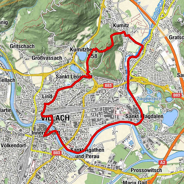
Innere Stadt0,1 kmVillach (501 m)0,5 kmLind1,2 kmSt. Leonhard2,4 kmKumitzberg (658 m)4,3 kmGasthof Brandenburg4,4 kmKumitz5,4 kmUrlaken5,8 kmSt. Magdalen8,7 kmWasenboden11,0 kmSpielplatz Freihausplatz12,2 kmInnere Stadt12,4 kmVillach Mosque12,4 kmDuomo San Giacomo12,4 km
- Punto álgido
- 638 m
- Descanso/Avituallamiento
-
diverse Einkehrmöglichkeiten in der Villacher Innenstadt
GPS Downloads


Superficie de carretera
Asfalto
Gravilla
Pradera
Bosque
Roca
Expuesto
Más circuitos por las regiones