


Datos del tour
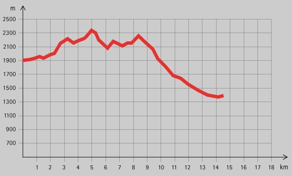
15,06km
1.325
- 2.294m
645hm
1.213hm
05:00h
- Breve descripción
-
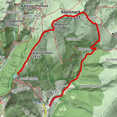
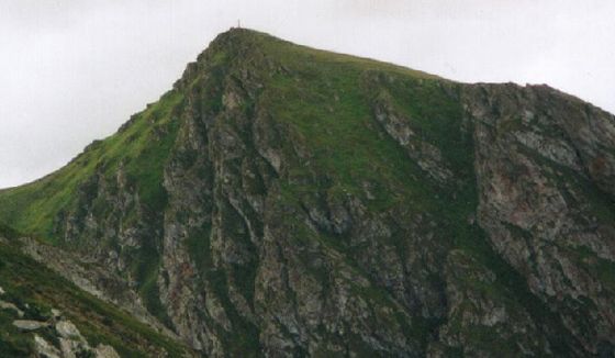
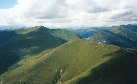
Tolle Höhenwanderung über vier bekannte Gipfel der Region. Herrliche Aussicht in die Landschaft der Nockberge!
- Dificultad
-
medio
- Valoración
-
- Punto de salida
-
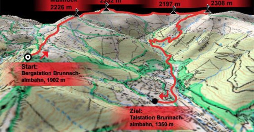
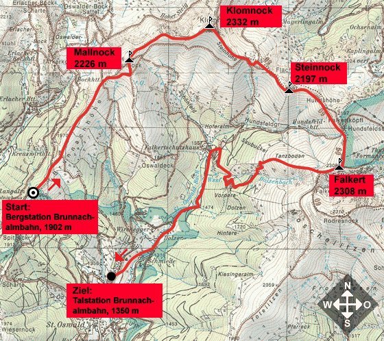
Bergstation Brunnachalmbahn (1902 m)
- Ruta
-
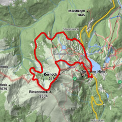
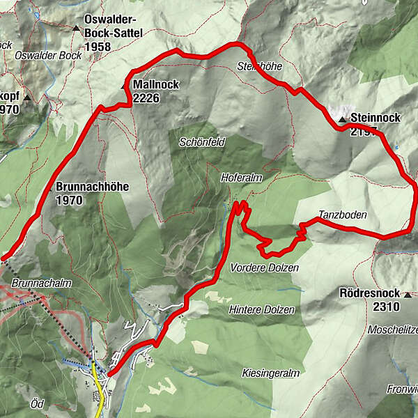
Brunnachhöhe (1.970 m)1,0 kmMallnock (2.226 m)2,9 kmKlomnock (2.331 m)4,5 kmFlache Scharte5,8 kmSteinnock (2.197 m)6,5 kmFalkert (2.308 m)8,3 km
- La mejor temporada
-
enefebmarabrmayjunjulagosepoctnovdic
- Punto álgido
- 2.294 m
- Descanso/Avituallamiento
-
Falkertschutzhaus (Gegen Ende der Tour gelegen!)
- Material cartográfico

GPS Downloads


Superficie de carretera
Asfalto
Gravilla
Pradera
Bosque
Roca
Expuesto
Más circuitos por las regiones