
Datos del tour
18,8km
486
- 589m
199hm
06:00h
- Breve descripción
-
großteils eben - Gehzeit in eine Richtung ca. 3 Std.
- Valoración
-
- Punto de salida
-
Stadtpfarrkirche St. Jakob
- Ruta
-
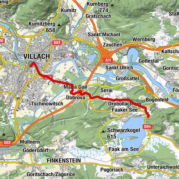
Villach MosqueDuomo San Giacomo0,0 kmInnere Stadt0,1 kmVillach (501 m)0,3 kmHeiligenkreuzkirche1,0 kmWallfahrtskirche Maria Gail3,6 kmMaria Gail3,9 kmProssowitsch4,2 kmSerai6,2 kmKratschach6,9 kmTürkei8,4 kmEgg am Faaker See9,3 km
- Punto álgido
- 589 m
- Descanso/Avituallamiento
-
Gasthof Moser - Maria Gail
Gasthof Tschebull - Egg
zahlreiche Einkehrmöglichkeiten in der Innenstadt von Villach
GPS Downloads


Superficie de carretera
Asfalto
Gravilla
Pradera
Bosque
Roca
Expuesto
Más circuitos por las regiones


