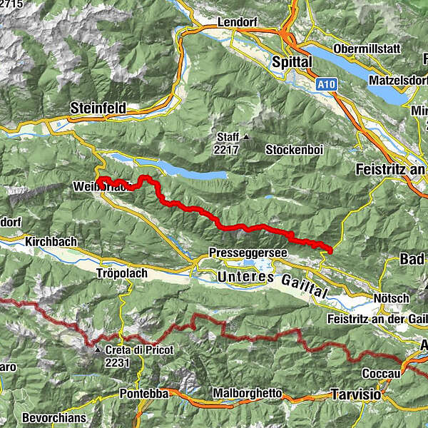
Gailtaler Höhenweg, Abschnitt Weißbriach-Windische Höhe

Senderismo


- Breve descripción
-
The entire trail is a magnificent but very long high-level hike over the Gailtal Alps, with magnificent views of the Gailtal and Weissensee, the Carnic and Julian Alps.
- Dificultad
-
medio
- Valoración
-
- Ruta
-
WeißbriachMosmüller1,1 kmMemmeralpl3,8 kmGföllnock (1.502 m)4,0 kmMittagsnock (1.473 m)5,2 kmNaggler Alm8,4 kmGeißrücken10,9 kmJadersdorfer Ochsenalm11,9 kmKohlröslhütte12,4 kmSattelköpfe (1.684 m)14,3 kmGolz (2.004 m)15,4 kmRadniger Sattel (1.554 m)16,6 kmSpitzegel (2.119 m)20,1 kmKriebhöhe (2.065 m)21,5 kmVellacher Egel (2.108 m)22,1 kmVellacher Sattel (1.858 m)23,3 kmGraslitzen (2.044 m)25,3 kmGraslitzen Ostgipfel (1.932 m)26,7 kmGeorgikapelle29,4 kmSussawitscher Sattel (1.418 m)30,2 km
- La mejor temporada
-
enefebmarabrmayjunjulagosepoctnovdic
- Punto álgido
- 2.079 m
- Punto final
-
Windische Höhe
- Perfil alto
-


- Autor
-
La gira Gailtaler Höhenweg, Abschnitt Weißbriach-Windische Höhe es utilizado por outdooractive.com proporcionado.
GPS Downloads


Información general
Vistas panorámicas
Más circuitos por las regiones