
- Breve descripción
-
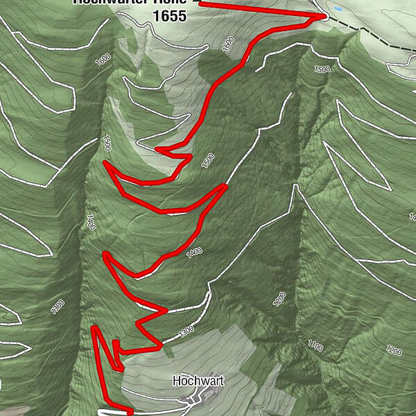
Von Hochwart über den Forstweg auf die Hochwarter Höhe, Abstieg über Schimanberger Höhe und Tramun - Waidegg möglich.
- Dificultad
-
medio
- Valoración
-
- Ruta
-
Hochwart0,7 kmHochwarter Höhe (1.655 m)3,8 km
- La mejor temporada
-
agosepoctnovdicenefebmarabrmayjunjul
- Punto álgido
- 1.647 m
- Punto final
-
Hochwarter Höhe (1.688 m)
- Perfil alto
-

- Autor
-
La gira Hochwarter Höhe es utilizado por outdooractive.com proporcionado.
GPS Downloads


Información general
Vistas panorámicas
Más circuitos por las regiones