Datos del tour
22,73km
952
- 3.020m
2.183hm
2.162hm
09:30h
- Breve descripción
-
2000hm Wanderung
- Valoración
-
- Punto de salida
-
Parkplatz Ghf. Falleralm
- Ruta
-
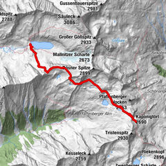
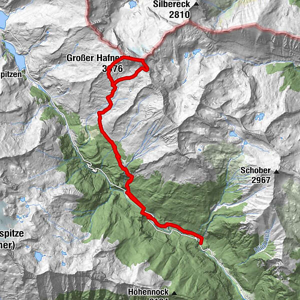
Melnikfall0,2 kmJausenstation Hohe Brücke2,2 kmHochalm waterfall3,4 kmGmünder Hütte3,5 kmKattowitzer Hütte8,3 kmGroßer Hafner (3.076 m)10,7 kmKleiner Hafner (3.018 m)11,1 kmLanischscharte (2.897 m)11,7 kmKattowitzer Hütte13,9 kmGmünder Hütte18,9 kmHochalm waterfall19,0 kmJausenstation Hohe Brücke20,5 kmMelnikfall22,3 km
- La mejor temporada
-
enefebmarabrmayjunjulagosepoctnovdic
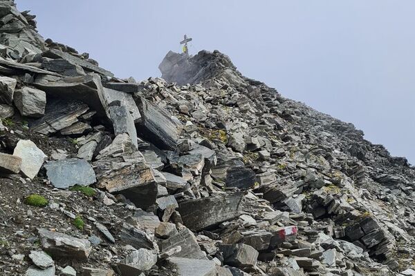
- Punto álgido
- 3.020 m
- Punto final
-
Großer Hafner und Kleiner Hafner
- Descanso/Avituallamiento
-
Gmündner Htt., Kattowitzer Htt.
GPS Downloads


Más circuitos por las regiones