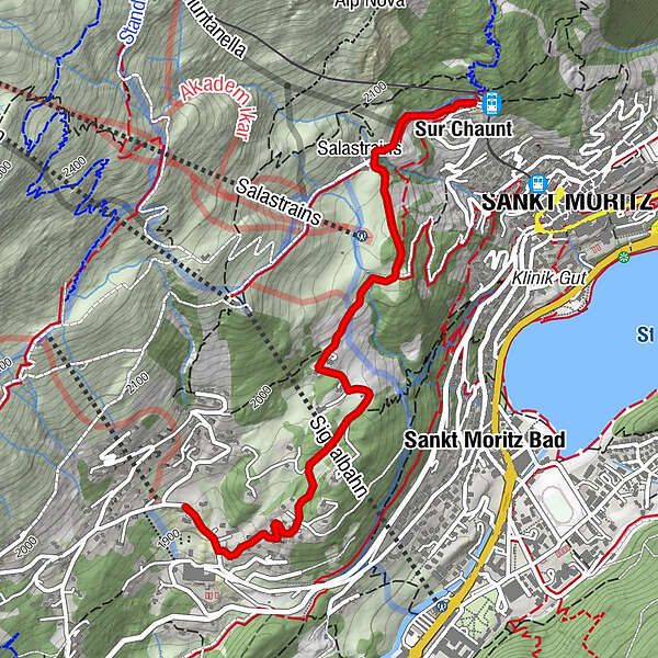
Chantarella - Salastrains - Chasellas

Senderismo de invierno


- Breve descripción
-
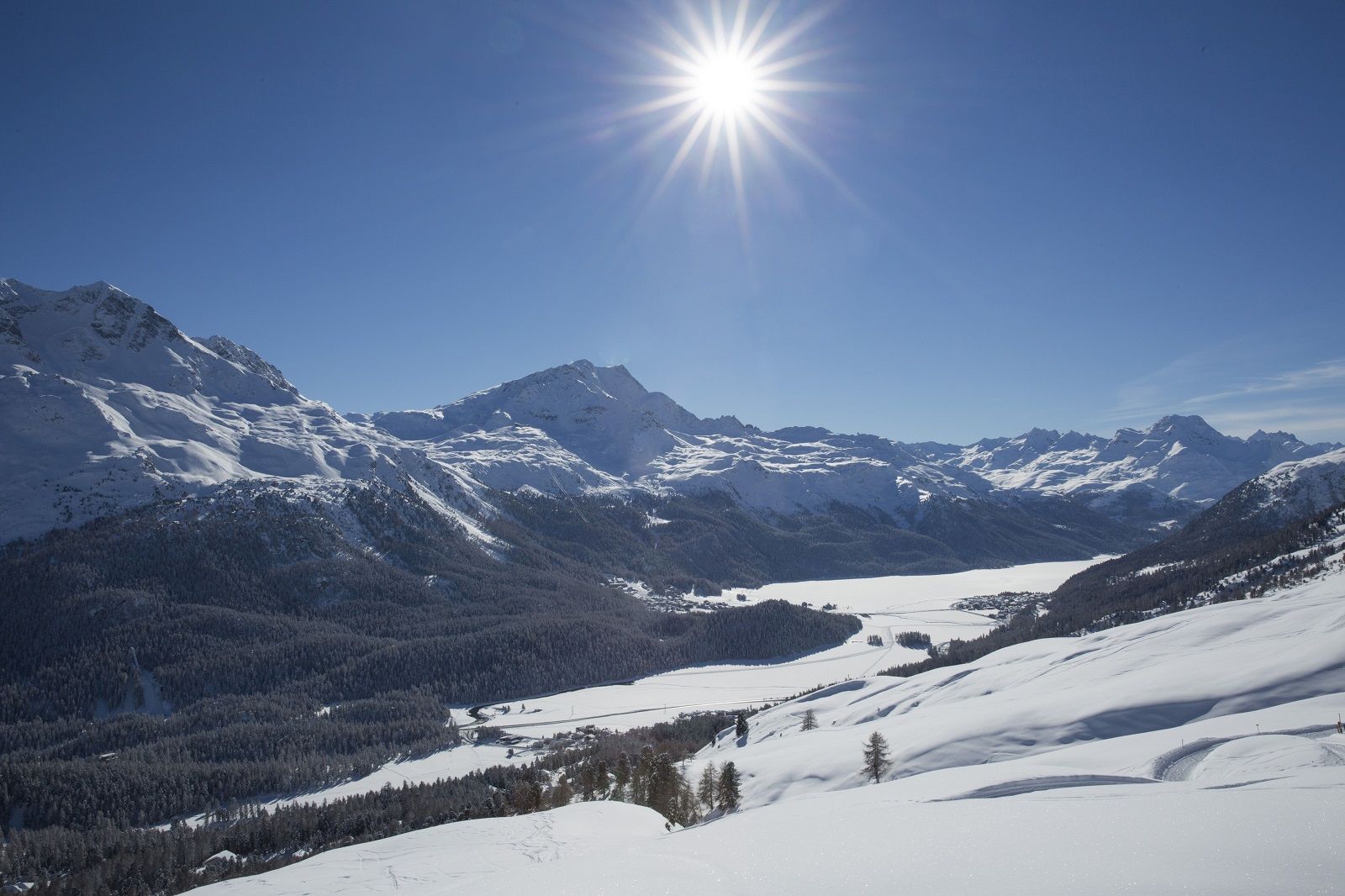
From St. Moritz village to Chantarella, you may just as well take the funicular. But then the sunny plateau of Salastrains comes into view.
- Dificultad
-
fácil
- Valoración
-
- Ruta
-
Sankt Moritz (1.822 m)Sur Chaunt0,1 kmSpielplatz Salastrains0,6 km
- La mejor temporada
-
agosepoctnovdicenefebmarabrmayjunjul
- Punto álgido
- 2.044 m
- Punto final
-
Chasellas
- Perfil alto
-
 © outdooractive.com
- Autor
-
La gira Chantarella - Salastrains - Chasellas es utilizado por outdooractive.com proporcionado.
GPS Downloads


Información general
Punto de avituallamiento
Vistas panorámicas
Más circuitos por las regiones
-
Veltlin / Valtellina
49
-
Engadin St. Moritz
102
-
St. Moritz
53