© Graubünden

© ©️Filme von Draussen

© ©️Filme von Draussen

© ©️Filme von Draussen

© ©️Filme von Draussen

© ©️Filme von Draussen

© ©️Filme von Draussen

© ©️Filme von Draussen

© ©️Filme von Draussen

- Breve descripción
-
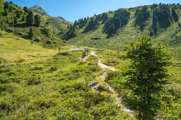
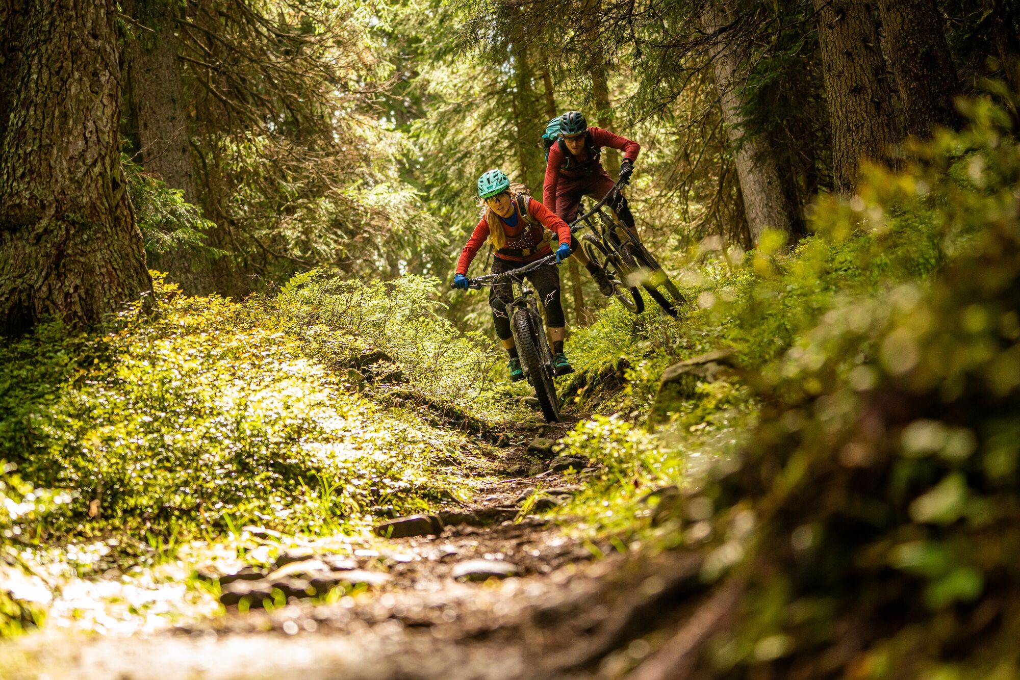
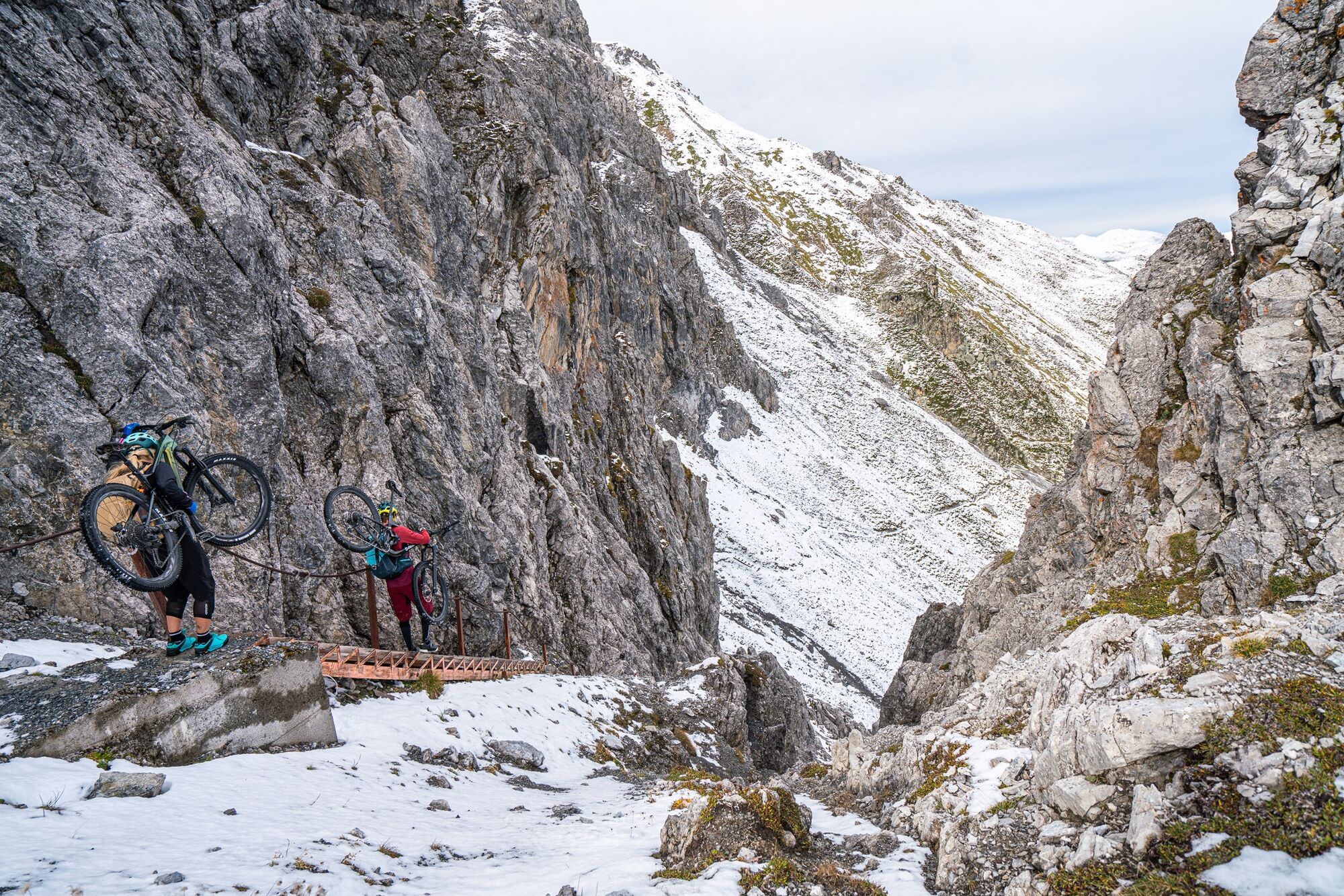
Who is behind the next bend? What is behind the next rock? Will the front wheel hold up or not? Not knowing what to expect is one of the beauties of biking. The tour over the Durannapass is a classic. With the new routing and the start from the Weissfluhpass, this trail experience is full of surprises.
- Dificultad
-
medio
- Valoración
-
- Ruta
-
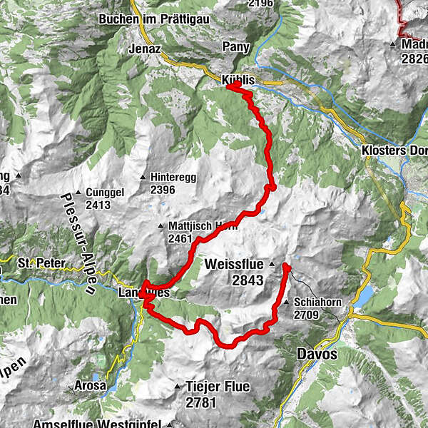
Weissfluhjoch (2.663 m)Strela-Pass3,0 kmStrelapass3,0 kmAlpenrose10,0 kmMedergen (2.000 m)10,1 kmJanetsch Boden (1.947 m)10,9 kmReformierte Kirche14,1 kmLangwies (1.373 m)14,4 kmStrassberg (1.919 m)20,0 kmBim Neue Hus20,8 kmReckholdern (1.960 m)21,5 kmBarga (1.994 m)22,5 kmObersäss (2.054 m)24,7 kmFideriser Duranna25,6 kmUntersäss (1.869 m)25,8 kmPlayground33,6 kmWaldspielplatz Tuss33,6 kmKüblis (816 m)33,8 kmTerminus34,0 kmRestaurant Bahnhöfli34,0 kmKüblis (810 m)34,0 km
- La mejor temporada
-
enefebmarabrmayjunjulagosepoctnovdic
- Punto álgido
- 2.649 m
- Punto final
-
Küblis
- Perfil alto
-
 © outdooractive.com


-

-
AutorLa gira Tritt-Durannapass es utilizado por outdooractive.com proporcionado.
GPS Downloads


Información general
Punto de avituallamiento
Vistas panorámicas
Más circuitos por las regiones
-
Heidiland
336
-
Davos Klosters
201
-
Fideriser Heuberge
113