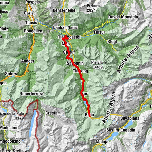
001.05 Alpine Bike Etappe 5 Bivio - Tiefencastel

Mountainbike

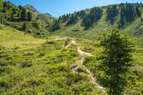
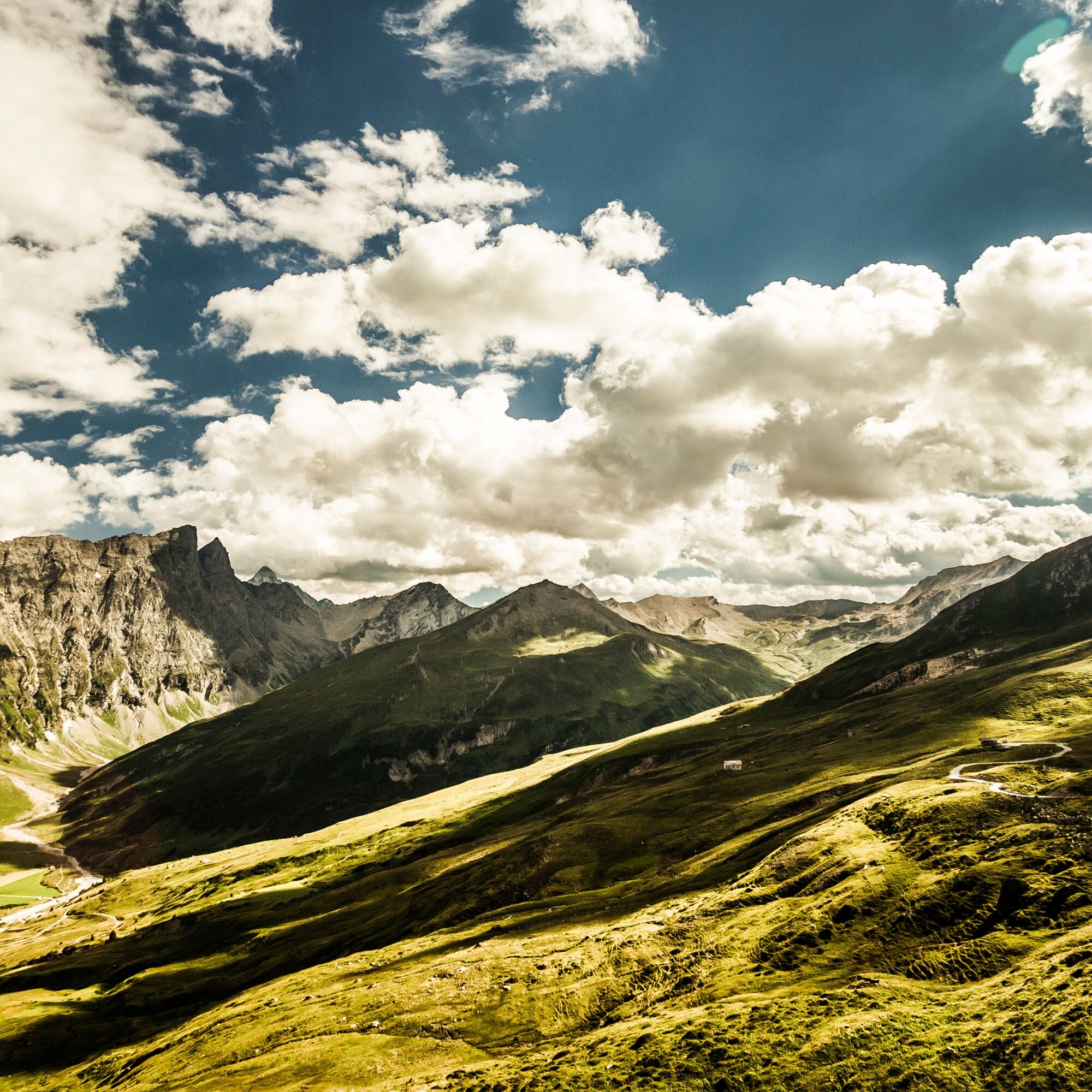
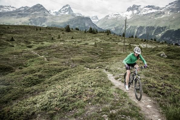
© Tourismus Savognin Bivio Albula AG - Cordula Seiler

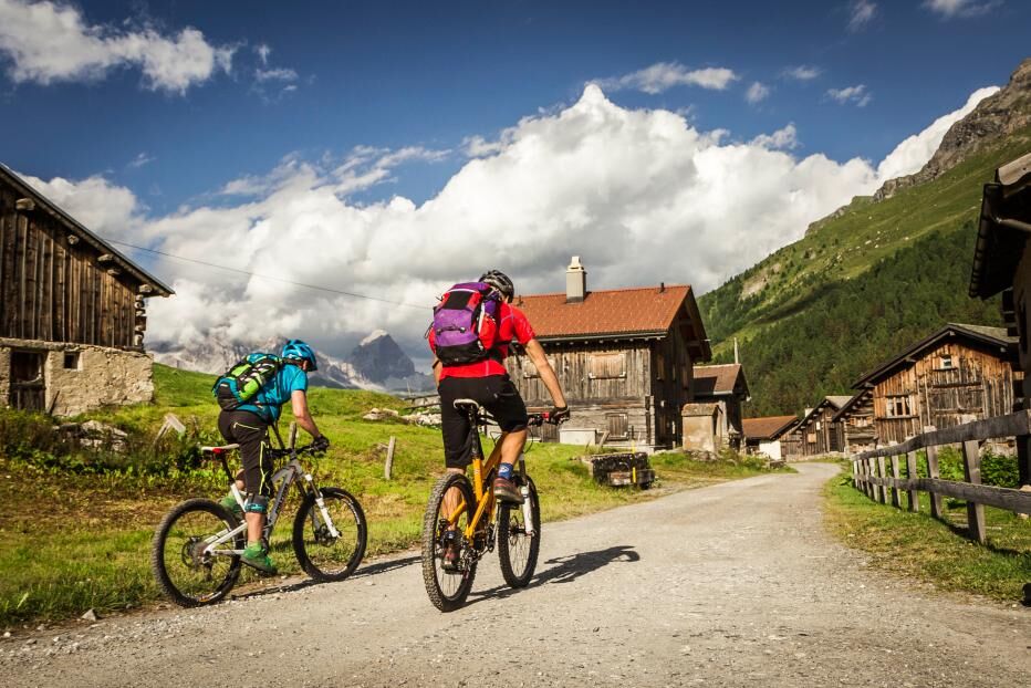
© Tourismus Savognin Bivio Albula AG - Cordula Seiler

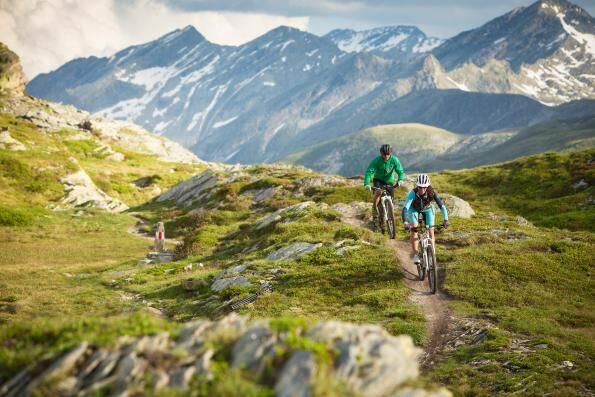
© Tourismus Savognin Bivio Albula AG - Cordula Seiler

© Tourismus Savognin Bivio Albula AG - Cordula Seiler

- Breve descripción
-
Zippy forest trail out of the valley, testing ascent at Sur, quiet section along the Roman Septimer route on a terrace high above the valley floor, excellent single trail with spectacular views.
- Dificultad
-
medio
- Valoración
-
- Ruta
-
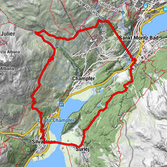
Reformierte Kirche Bivio0,0 kmBaselgia San Giagl0,0 kmGravella0,1 kmBivio (1.769 m)0,1 kmMotta Cruschetta3,8 kmPardeala Sot3,9 kmAgls Bluaders4,0 kmMarmels (1.720 m)4,1 kmBluders4,2 kmRestaurant Marmorerasee5,6 kmCrap digls Giz5,6 kmRiz5,8 kmScalotta (1.586 m)7,2 kmSur (1.530 m)8,0 kmMühlen (1.481 m)8,6 kmSant Franziskus Kirche8,8 kmRoffna (1.408 m)13,0 kmCampingplatz Rona13,4 kmTinzen (1.232 m)17,1 kmSavognin (1.207 m)19,5 kmPizzeria Allegra19,8 kmRestaurant Florian's20,1 kmConters (1.182 m)21,5 kmRiom22,0 kmBaselgia San Luregn22,1 kmUstaraia Taratsch22,3 kmParsonz23,0 kmSalux (1.258 m)25,3 kmGasthaus Alpina25,3 kmKatholische Kirche Son Gieri25,8 kmNavaras27,3 kmMon (1.231 m)28,9 kmTiefencastel (859 m)32,4 km
- La mejor temporada
-
enefebmarabrmayjunjulagosepoctnovdic
- Punto álgido
- 1.815 m
- Punto final
-
Tiefencastel
- Perfil alto
-
 © outdooractive.com
- Autor
-
La gira 001.05 Alpine Bike Etappe 5 Bivio - Tiefencastel es utilizado por outdooractive.com proporcionado.
GPS Downloads


Información general
Punto de avituallamiento
Fauna
Vistas panorámicas
Más circuitos por las regiones
-
Val Surses
208
-
Savognin
22