© Prättigau Tourismus - Prättigau Tourismus GmbH

© Graubünden Ferien

© Prättigau Tourismus - Post Schuders

© Prättigau Tourismus GmbH
- Breve descripción
-
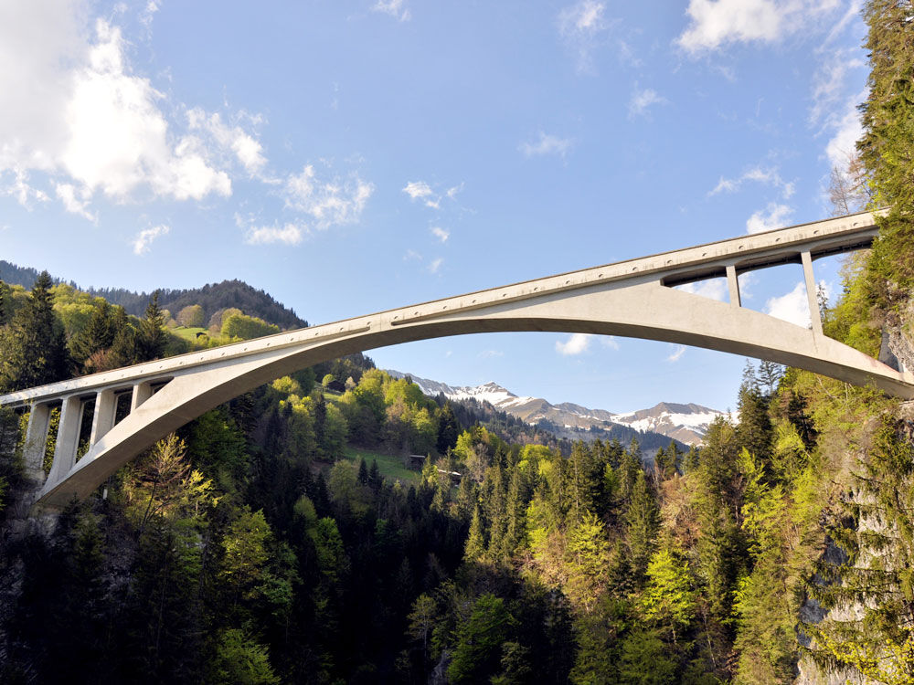
This tour takes us past a ruggedly romantic river landscape to the international historic landmark of the Salginatobel Bridge. The elegant arch bridge spans the Salgina Gorge at a height of more than 90 m.
- Dificultad
-
medio
- Valoración
-
- Ruta
-
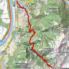
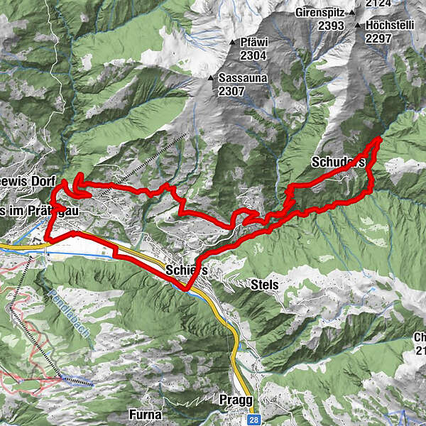
Bruder Klaus0,3 kmSchiers (665 m)0,3 kmMontagna0,8 kmFajauna (862 m)1,1 kmSchuders8,7 kmReformierte Kirche Schuders8,8 kmBerggasthof Alte Post8,9 kmPusserein14,0 kmChobel14,9 kmLengtrog15,3 kmJoder15,6 kmHinder Lasein15,8 kmLasein15,9 kmPlamaria16,8 kmFanas (907 m)18,8 kmReformierte Kirche23,2 kmGrüsch (630 m)23,6 kmSchiers (665 m)27,7 km
- La mejor temporada
-
enefebmarabrmayjunjulagosepoctnovdic
- Punto álgido
- 1.272 m
- Punto final
-
Schiers
- Perfil alto
-
 © outdooractive.com


- Autor
-
La gira 322 Salginatobelbrücke es utilizado por outdooractive.com proporcionado.
GPS Downloads


Información general
Punto de avituallamiento
Cultural/Histórico
Vistas panorámicas