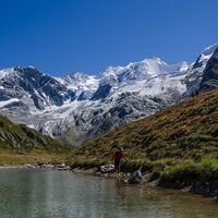
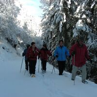
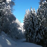
Invierno
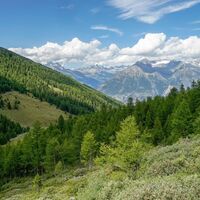
Verano
El tiempo
Webcams
Alojamientos
Excursiones
Historial de búsqueda
Sugerencias de búsqueda
No se han encontrado resultados
Buscar en
Excursiones
Inicio
Verano Schweiz
Valais
Oberwallis
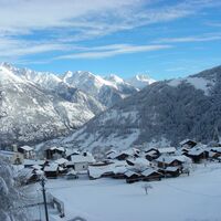
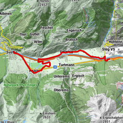
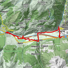
Gampel-Bratsch
Excursiones
Región
El tiempo
Webcams
Excursiones
Deporte
Foro
Estación de esquí
Excursiones
Gampel-Bratsch
Mapa
mostrar
ocultar
Filtro de circuitos
Tipo de excursión
(Todos)
Senderismo (893)
Sendero temático (62)
long-distance walking trail (27)
Mountain hiking (4)
Camino de peregrinación (4)
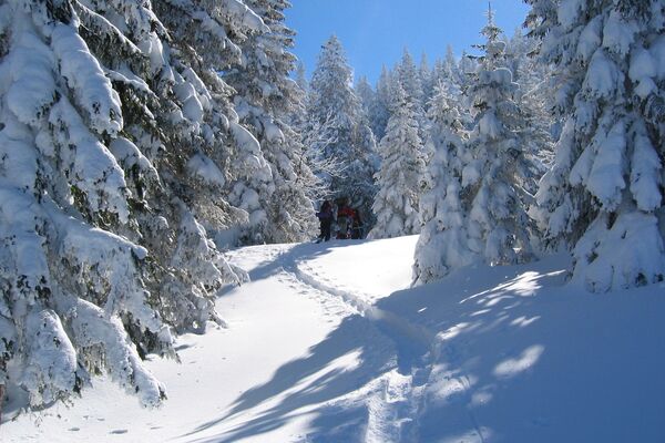
Senderismo de invierno (174)
Raquetas de nieve (96)
Esquí de travesía (62)
Trineo (23)
Ski-Freeride (4)
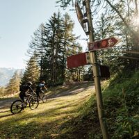
Mountainbike (116)
Ciclismo (71)
E-MTB (10)
Ciclismo de carrera (2)
Ciclismo de larga distancia (1)
E-Bike (1)
Trailrunning (54)
Running (5)
Vía ferrata (19)
Excursión de alta montaña (9)
Escalada (7)
Motorcycle (2)
Búsqueda de texto completo
Nivel
mín.
1 fácil
2 moderadamente
3 mediana dificultad
4 dificultad alta
5 muy difícil
6 extremo
máx.
1 fácil
2 moderadamente
3 mediana dificultad
4 dificultad alta
5 muy difícil
6 extremo
Técnica
mín.
1 fácil
2 moderadamente
3 mediana dificultad
4 dificultad alta
5 muy difícil
6 extremo
máx.
1 fácil
2 moderadamente
3 mediana dificultad
4 dificultad alta
5 muy difícil
6 extremo
Longitud (km)
Metros de altura
otros filtros
Buscar
Posponer
1.646 Excursiones.
ordenado por
Relevanz
Relevancia
längste Distanz
kürzeste Distanz
duración máxima
duración mínima
metros más verticales
menos metros verticales
alto estado
baja condición
alta tecnología
baja tecnología
Nombre A-Z
Nombre Z-A
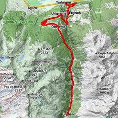
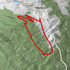
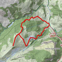
Gruben – Höhenpfad – Oberems
difícil
Senderismo
13,52
km
05:00
h
612
hm
1.331 - 2.256
m
Técnica
Nivel
Wanderung Oberems - Bella Tola
difícil
Senderismo
10,88
km
05:00
h
1.589
hm
1.341 - 2.999
m
Técnica
Nivel
Turtmanntal - Scenic & side valleys
difícil
Ciclismo
18,44
km
02:18
h
1.036
hm
628 - 1.820
m
Técnica
Nivel
Von Eischoll auf das Signalhorn
difícil
Senderismo
18,88
km
07:30
h
1.264
hm
1.217 - 2.885
m
Técnica
Nivel
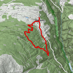
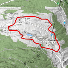
Oberems snow-shoe trail
medio
Raquetas de nieve
4,6
km
02:00
h
341
hm
1.331 - 1.688
m
Técnica
Nivel
Schneeschuhtour Oberems
medio
Raquetas de nieve
2,8
km
01:45
h
214
hm
1.347 - 1.558
m
Técnica
Nivel
Oberems-Bort Snow-shoe Trail
fácil
Raquetas de nieve
2,9
km
01:00
h
105
hm
1.272 - 1.369
m
Técnica
Nivel
Valais Alpine Bike - Full itinerary
medio
Mountainbike
316,73
km
25:25
h
12.596
hm
522 - 2.850
m
Técnica
Nivel
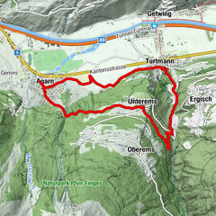
Abwechslungsreich: Rundtour um Turtmann
medio
Senderismo
14,27
km
05:00
h
683
hm
620 - 1.125
m
Técnica
Nivel
Dachspfad
medio
Senderismo
11,03
km
04:00
h
412
hm
619 - 1.037
m
Técnica
Nivel
Lunggi Trail
medio
Mountainbike
14,81
km
01:50
h
520
hm
631 - 1.762
m
Técnica
Nivel
Bhutanbrücke
fácil
Senderismo
10,47
km
03:10
h
206
hm
623 - 1.003
m
Técnica
Nivel
Unterems - BhutanBridge - Leuk
medio
Senderismo
13,05
km
04:30
h
578
hm
621 - 1.003
m
Técnica
Nivel
Hopschilpfad
medio
Senderismo
9,36
km
03:30
h
485
hm
627 - 1.067
m
Técnica
Nivel
For families (biketour)
fácil
Ciclismo
13,33
km
01:30
h
22
hm
619 - 636
m
Técnica
Nivel
Bird-watching Tour
medio
Senderismo
14,61
km
05:00
h
417
hm
618 - 994
m
Técnica
Nivel
Wild herbs and rye
difícil
Ciclismo
44,7
km
05:00
h
1.685
hm
619 - 1.584
m
Técnica
Nivel
Along the Water
fácil
Ciclismo
15,51
km
01:30
h
40
hm
617 - 651
m
Técnica
Nivel
Walk Leuk - Agarn
medio
Senderismo
11,28
km
03:30
h
196
hm
617 - 1.068
m
Técnica
Nivel
Savurando Naturpark Pfyn-Finges
fácil
Sendero temático
0,04
km
06:00
h
-
623 - 623
m
Técnica
Nivel
Páginas:
1
2
3
4
5
6
7
8
siguiente
Tous según tipos
Senderismo
Invierno
Bike
Running
Alpino
Motorsport
Touren nach Regionen
Oberwallis
373
Gipfeltouren in der Region
Albristhorn (2.762 m)
5
Üssers Barrhorn (3.610 m)
5
Bella Tola (3.025 m)
5
Torrenthorn (2.997 m)
5
First (2.548 m)
5
Üssers Barrhorn Nord (3.592 m)
4
Corne de Sorebois (2.895 m)
13
Iffighorn (2.378 m)
4
Crêt du Midi (2.332 m)
6
Seewlehore (2.467 m)
5
Excursiones opcionales por los alrededores
Skitouring- Track Pörisgrat (signposted)
fácil
Esquí de travesía
5,7
km |
586
hm |
01:40
h
Spuren im Schnee
medio
Senderismo de invierno
4,38
km |
254
hm |
01:35
h
Gletschergrotte Winter Hiking Trail
fácil
Senderismo de invierno
2,1
km |
188
hm |
01:00
h
Höhenweg Kreuzboden - Almagelleralp - Saas-Almagell
Senderismo
9,74
km |
151
hm |
03:30
h
Vecinos
Turtmanntal
Moosalpregion
Unterbäch
Leuk/Leukerbad
Lötschental
Regiones favoritas
Simplon
Brig Simplon
Zermatt
Gondo-Zwischbergen
Aletsch Arena
Goms
Saas-Fee
Bürchen
Blatten-Belalp
Saas Grund - Hohsaas
Raron-Niedergesteln
Arolla
Thyon les Collons
Zinal
Pays du Saint-Bernard
St-Luc / Chandolin
Champéry
Rund um Visp
Grächen - St. Niklaus
Brig-Glis
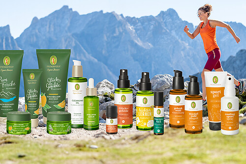
Sorteo
Produkt-Paket für die ganze Familie
Primavera XXL-Gewinnspiel
No se han encontrado entradas.
La búsqueda no está disponible actualmente.
Afine su búsqueda.
Resultados de la búsqueda local
(<= 25km)
Más resultados
(> 25km)
%count% Resultados de búsqueda
%name%
%type%
%elevation%
%population%
%lpButton%