Invierno
Verano
El tiempo
Webcams
Alojamientos
Excursiones
Historial de búsqueda
Sugerencias de búsqueda
No se han encontrado resultados
Buscar en
Excursiones
Inicio
Verano Österreich
Alta Austria
Innviertel
Eggerding
Excursiones
Región
El tiempo
Webcams
Excursiones
Deporte
Foro
Excursiones
Eggerding
Mapa
mostrar
ocultar
Filtro de circuitos
Tipo de excursión
(Todos)
Senderismo (18)
long-distance walking trail (1)
Camino de peregrinación (1)
Ciclismo (14)
Mountainbike (7)
E-MTB (3)
E-Bike (3)
Ciclismo de larga distancia (2)
Running (5)
Nordic Walking (2)
Senderismo de invierno (1)
Montar a caballo (1)
Búsqueda de texto completo
Nivel
mín.
1 fácil
2 moderadamente
3 mediana dificultad
4 dificultad alta
5 muy difícil
6 extremo
máx.
1 fácil
2 moderadamente
3 mediana dificultad
4 dificultad alta
5 muy difícil
6 extremo
Técnica
mín.
1 fácil
2 moderadamente
3 mediana dificultad
4 dificultad alta
5 muy difícil
6 extremo
máx.
1 fácil
2 moderadamente
3 mediana dificultad
4 dificultad alta
5 muy difícil
6 extremo
Longitud (km)
Metros de altura
otros filtros
Buscar
Posponer
58 Excursiones.
ordenado por
Relevanz
Relevancia
längste Distanz
kürzeste Distanz
duración máxima
duración mínima
metros más verticales
menos metros verticales
alto estado
baja condición
alta tecnología
baja tecnología
Nombre A-Z
Nombre Z-A
MTB Süd - Strecke
fácil
Mountainbike
19,39
km
01:15
h
87
hm
323 - 379
m
Técnica
Nivel
Eggerding Badesee
Senderismo
8,6
km
02:08
h
61
hm
351 - 451
m
R5 Hoher - Schacher - Runde (Mountainbike)
difícil
Mountainbike
2,0
25,33
km
01:57
h
314
hm
342 - 494
m
Técnica
Nivel
Pramtalradweg R21
fácil
Ciclismo de larga distancia
2,3
28,5
km
02:30
h
149
hm
304 - 368
m
Técnica
Nivel
Reitweg Andorf
Montar a caballo
18,14
km
01:30
h
103
hm
337 - 394
m
Auen-Circuit Rain -walking tour - W1
difícil
Senderismo
8,61
km
02:10
h
21
hm
335 - 360
m
Técnica
Nivel
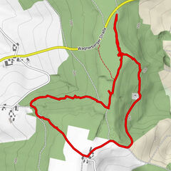
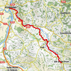
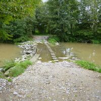
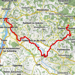
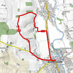
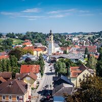
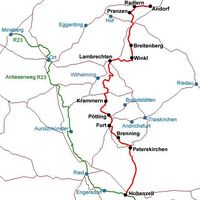
Z02 Schärding - Andorf | Weg des Buches Zentral
medio
Camino de peregrinación
20,33
km
06:30
h
102
hm
306 - 374
m
Técnica
Nivel
R1.02 Pram-Sauwald-Tour
fácil
Ciclismo
38,15
km
02:50
h
442
hm
304 - 596
m
Técnica
Nivel
MTB Nord - Strecke
medio
Mountainbike
25,07
km
01:48
h
384
hm
323 - 457
m
Técnica
Nivel
Innviertlerweg R22
difícil
Ciclismo
32,08
km
02:00
h
343
hm
345 - 533
m
Técnica
Nivel
Innviertel Bike Path R22
medio
Mountainbike
32,6
km
02:27
h
462
hm
344 - 534
m
Técnica
Nivel
Löffler Runde
medio
Running
5,24
km
00:49
h
48
hm
394 - 444
m
Técnica
Nivel
Stranzinger Runde
medio
Running
7,45
km
01:09
h
82
hm
399 - 478
m
Técnica
Nivel
Hennaberg Runde
medio
Running
4,86
km
00:46
h
76
hm
399 - 476
m
Técnica
Nivel
Scheuch Runde
fácil
Running
3,14
km
00:28
h
12
hm
400 - 421
m
Técnica
Nivel
Schloss-Tour 231
fácil
Ciclismo
13,63
km
01:00
h
79
hm
387 - 443
m
Técnica
Nivel
Teuflauauer Holz - W2
Senderismo
11,18
km
02:50
h
100
hm
340 - 407
m
Pramtal Museums-Weg
Senderismo
30,65
km
07:34
h
114
hm
304 - 356
m
Tour Fisch
Ciclismo
49,83
km
03:30
h
140
hm
305 - 355
m
Hans Bogner
39,51
km
02:13
h
320
hm
243 - 454
m
Técnica
Nivel
Páginas:
1
2
3
siguiente
Tous según tipos
Bike
Senderismo
Running
Invierno
Otros
Touren nach Regionen
Innviertel
23
Gipfeltouren in der Region
Excursiones opcionales por los alrededores
Rothenberg
fácil
Senderismo
3,69
km |
76
hm |
00:50
h
MTB Nord - Strecke
medio
Mountainbike
25,07
km |
384
hm |
01:48
h
Marterlweg 2 (Tischling)
Senderismo
8,5
km |
78
hm |
02:00
h
R8 "Vom Pramtaler Knödelweg zum Baumkronenweg"
difícil
Mountainbike
37,27
km |
557
hm |
02:30
h
Vecinos
Mayrhof
Lambrechten
St. Marienkirchen bei Schärding
Ort im Innkreis
St. Martin im Innkreis
Regiones favoritas
Linz
Steyr
Bad Ischl
Gmunden
Bad Goisern
Wels
Mondsee am Mondsee
Altmünster
Vöcklabruck
Windischgarsten
Grünberg-Gmunden
Attersee am Attersee
Ebensee - Feuerkogel
Großraming
Ried im Innkreis
Freistadt
Ternberg
Kirchdorf an der Krems
Scharnstein im Almtal
Molln
Sorteo
Produkt-Paket für die ganze Familie
Primavera XXL-Gewinnspiel
No se han encontrado entradas.
La búsqueda no está disponible actualmente.
Afine su búsqueda.
Resultados de la búsqueda local
(<= 25km)
Más resultados
(> 25km)
%count% Resultados de búsqueda
%name%
%type%
%elevation%
%population%
%lpButton%