Via Dinarica HR-W-27 Route of Our Lady of Sinj

© Terra Dinarica - Alan Čaplar

- Breve descripción
-
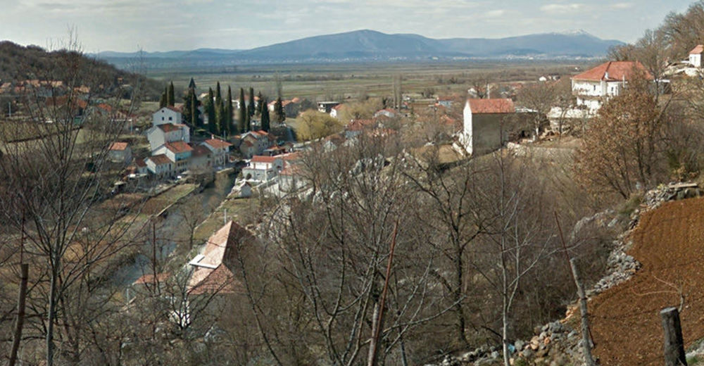
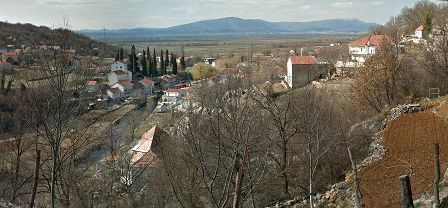
Route of Our Lady of Sinj is a pilgrimage trail used for centuries to access the largest pilgrimage site of Our Lady in southern Croatia on foot, from several directions. Every year, on the eve of the Assumption Day, in the nights from 8 until 15 August, thousands of pilgrims, especially young people, go on pilgrimage to the city of Sinj. The central religious ceremony is held on 15 August. Pilgrims reach their destination from several directions, but mostly from Solin from the south, and from Bosnia and Herzegovina from the north.
- Dificultad
-
medio
- Valoración
-
- Ruta
-
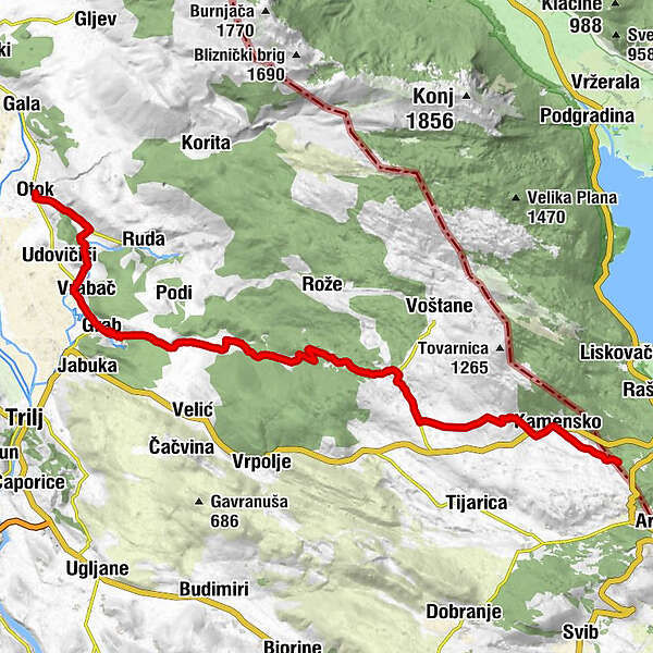
Sušići0,0 kmOtok0,0 kmOvrlja1,2 kmTadići2,3 kmVrabač5,1 kmBošnjaci6,0 kmGrab6,4 kmKrivodol11,3 kmGilići12,4 kmVučini16,9 kmŠipići17,5 kmLjut18,1 kmVitrenjača (910 m)23,5 kmBrčići25,0 kmKamensko26,8 kmRestoran ALKAR26,9 kmDonji Tabak27,3 km
- La mejor temporada
-
enefebmarabrmayjunjulagosepoctnovdic
- Punto álgido
- 896 m
- Punto final
-
Granični prijelaz Kamensko
- Perfil alto
-
 © outdooractive.com
-

-
AutorLa gira Via Dinarica HR-W-27 Route of Our Lady of Sinj es utilizado por outdooractive.com proporcionado.