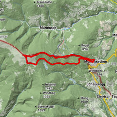
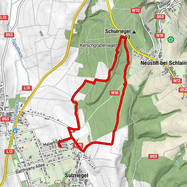
Sulzriegel Waldrunde Jormannsdorf, Burgenland

Senderismo


Datos del tour
4,88km
383
- 448m
65hm
53hm
01:26h
- Dificultad
-
fácil
- Valoración
-
- Ruta
-
Sulzriegel4,4 km
- La mejor temporada
-
enefebmarabrmayjunjulagosepoctnovdic
- Punto álgido
- 448 m
- Documentación
-

GPS Downloads


Superficie de carretera
Asfalto
Gravilla
Pradera
Bosque
Roca
Expuesto
Más circuitos por las regiones