- Breve descripción
-
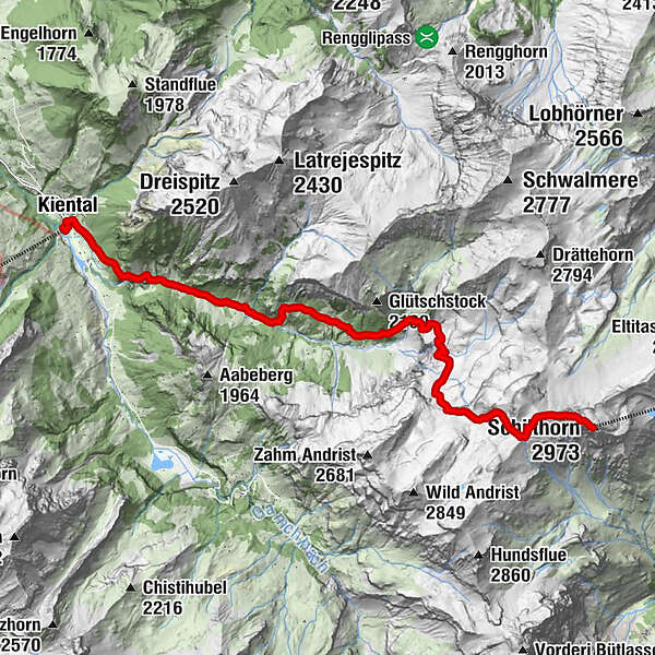
The long ascent from Kiental to the Schilthorn is much less frequently travelled than the one from Wengen. You first cross the Spiggengrund with its lush meadows, reach a fascinating karst landscape after Hohkien and finally cross a rocky desert at Rote Härd.
- Dificultad
-
medio
- Valoración
-
- Ruta
-
Kiental (958 m)0,3 kmSpiggenweide3,3 kmTschäggeren3,7 kmUnterburg5,8 kmGrunerli6,3 kmSchilthorn13,4 kmSkyline View Platform13,5 kmDrehrestaurant Piz Gloria13,5 km
- La mejor temporada
-
enefebmarabrmayjunjulagosepoctnovdic
- Punto álgido
- 2.957 m
- Punto final
-
Schilthorn
- Perfil alto
-
 © outdooractive.com

- Autor
-
La gira Kiental - Hohkien - Schilthorn es utilizado por outdooractive.com proporcionado.
GPS Downloads


Información general
Vistas panorámicas
Más circuitos por las regiones
-
Oberwallis
1872
-
Thunersee
1055
-
Kiental
266