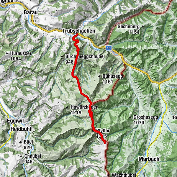
Höhenweg Entlebuch Emmental - Etappe 4: Trubschachen – Grosshorben

Senderismo

© Emmental Tourismus - Fabienne Röösli

© UNESCO Biosphäre Entlebuch

© Emmental Tourismus

© Emmental Tourismus
- Breve descripción
-
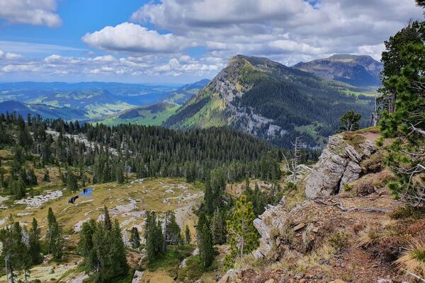
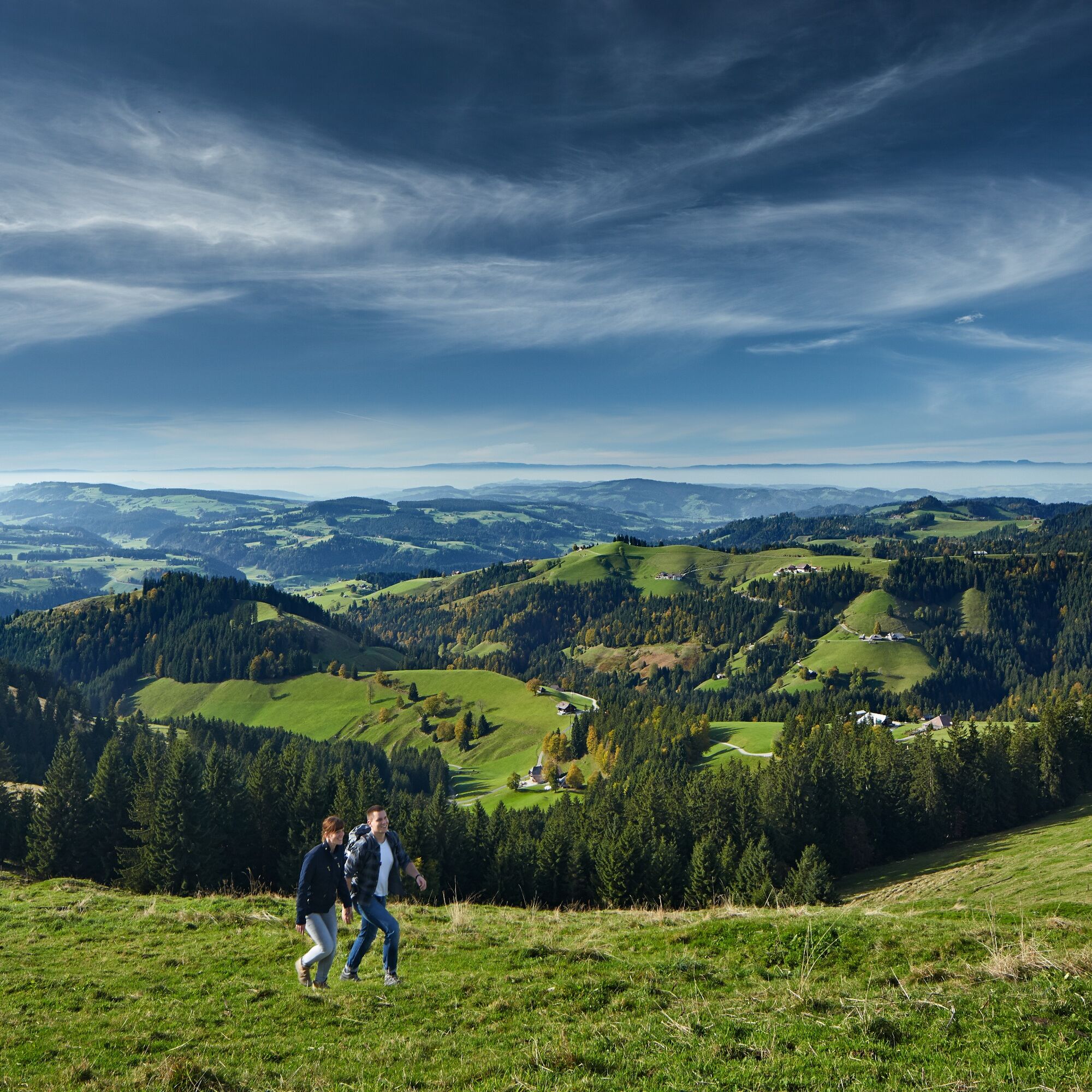
Die vierte Etappe führt über die Emmentaler "Höger" und bietet fantastische Ausblicke.
- Dificultad
-
medio
- Valoración
-
- Ruta
-
TrubschachenChäserenegg (1.269 m)5,1 kmRämisgummehoger (1.300 m)6,8 kmHinter Rämisgummen7,5 kmPfyffer (1.315 m)7,9 kmBrunnenboden8,6 km
- La mejor temporada
-
enefebmarabrmayjunjulagosepoctnovdic
- Punto álgido
- 1.296 m
- Punto final
-
Grosshorben
- Perfil alto
-
 © outdooractive.com


-

-
AutorLa gira Höhenweg Entlebuch Emmental - Etappe 4: Trubschachen – Grosshorben es utilizado por outdooractive.com proporcionado.
GPS Downloads


Información general
Punto de avituallamiento
Flora
Vistas panorámicas
Más circuitos por las regiones
-
Obwalden
2014
-
Emmental
550
-
Trubschachen
159