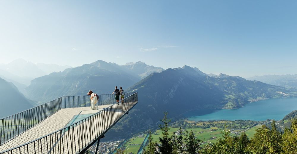
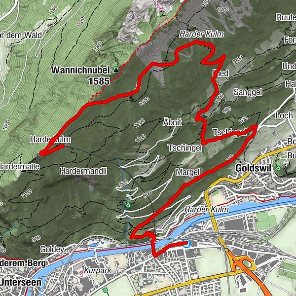
Interlaken - Goldswil - Baumgartisegg - Harder Kulm

Senderismo

- Valoración
-
- Ruta
-
Interlaken Ost (567 m)Hohbühl0,8 kmInterlaken (568 m)0,8 kmMargel1,6 kmGoldswil2,1 kmGoldswilallmend2,1 kmÄgertli2,2 kmBaumgärtli2,3 kmWeidliboden2,3 kmTschingel2,7 kmTschingel2,9 kmTschuggen3,6 kmRied3,7 kmHarderkulm6,3 kmPanorama-Restaurant Harder-Kulm6,5 km
- La mejor temporada
-
enefebmarabrmayjunjulagosepoctnovdic
- Punto álgido
- 1.430 m
- Punto final
-
Harderbahn, Bergstation
- Perfil alto
-
 © outdooractive.com

- Autor
-
La gira Interlaken - Goldswil - Baumgartisegg - Harder Kulm es utilizado por outdooractive.com proporcionado.
GPS Downloads


Información general
Punto de avituallamiento
Más circuitos por las regiones
-
Obwalden
2011
-
Interlaken
1098
-
Interlaken - Matten - Unterseen
460


