Tour to Grindelwald, the Glacier Village

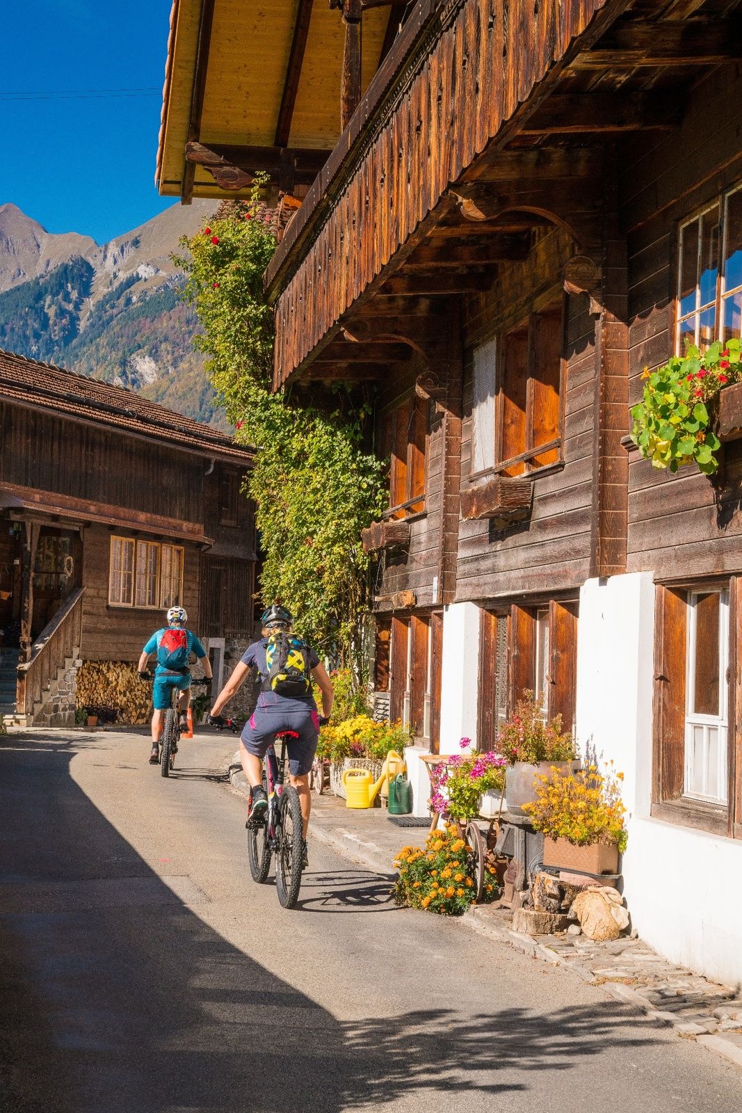
Mountainbike

© Interlaken Tourismus - Melanie Studer


© Unbekannt - Melanie Studer

© Interlaken Tourismus - Melanie Studer

- Breve descripción
-
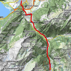
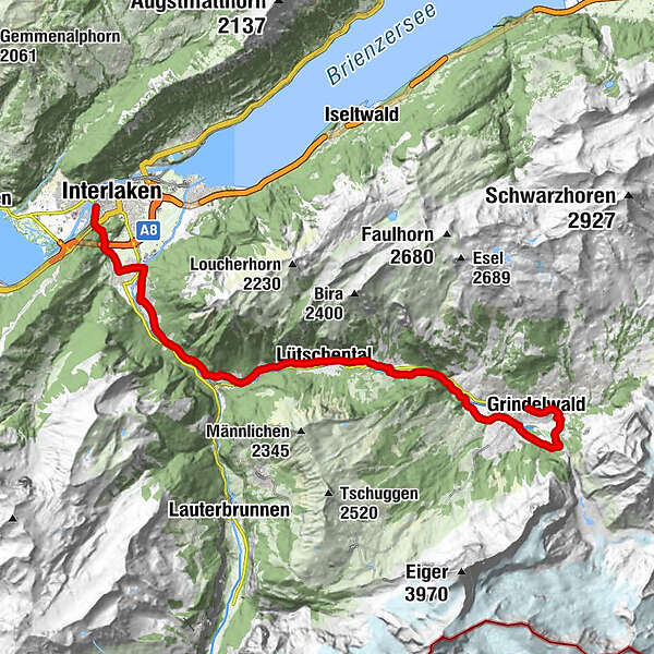
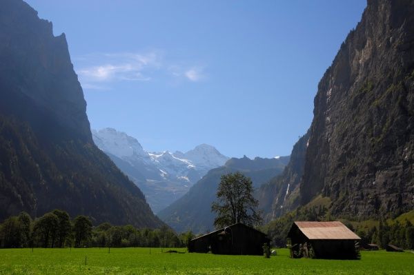
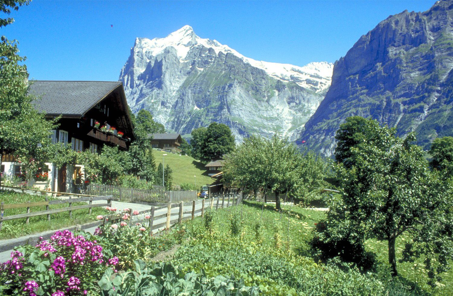
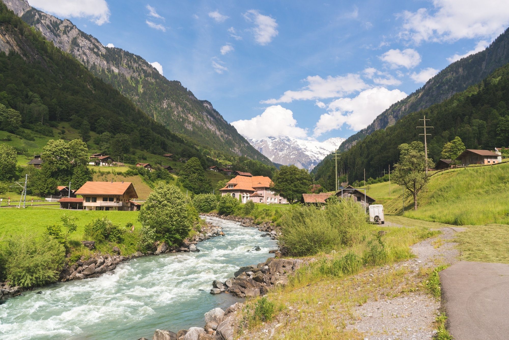
A gentle ascent alongside the River Lütschine to Zweitlütschinen. From here, a somewhat steeper trail leads over meadows and through charming hamlets to Grindelwald.
- Dificultad
-
medio
- Valoración
-
- Ruta
-
Unterseen (567 m)Interlaken (568 m)Interlaken West (564 m)Möösli0,2 kmWagneren0,6 kmWagnerschlucht0,7 kmUnspunnen1,2 kmWilderswil2,7 kmWilderswil (584 m)3,1 kmGsteig3,3 kmKirche Gsteig3,4 kmSteakhouse Steinbock3,5 kmGsteigwiler4,9 kmZweilütschinen8,2 kmBlasi8,2 kmMoosmatte8,5 kmIm Zaun8,5 kmGündlischwand8,7 kmLüüwi8,7 kmBletscha8,7 kmBoden8,7 kmBurghalte8,8 kmGässli8,9 kmHübeli8,9 kmDorfstrasse9,1 kmMurerli9,2 kmEyetli9,3 kmRüdli9,5 kmGufrit9,8 kmStaldi9,8 kmAebnit10,0 kmChalchweidli10,4 kmAm Chienbach10,4 kmBaumgarten10,6 kmSteinen11,0 kmLischen11,1 kmLischenstutz11,2 kmWyden11,2 kmLauenen11,6 kmHüslimatte11,7 kmGietli12,1 kmBriggmättli12,2 kmLütschental12,2 kmBodenacher12,3 kmStegmatte12,4 kmUnter dem Rain12,5 kmRain12,5 kmBuchholz12,6 kmGadenstatt12,9 kmSteinenegg13,0 kmStaldenweidli13,2 kmStalden13,5 kmHotel-Restaurant Stalden13,7 kmBurglauenen14,3 kmBurglauenen14,4 kmSchwendi17,0 kmRestaurant Grund19,2 kmGrindelwald23,6 kmSwiss Alp Resort23,9 km
- La mejor temporada
-
enefebmarabrmayjunjulagosepoctnovdic
- Punto álgido
- 1.045 m
- Punto final
-
Grindelwald, Bahnhof
- Perfil alto
-
 © outdooractive.com
- Autor
-
La gira Tour to Grindelwald, the Glacier Village es utilizado por outdooractive.com proporcionado.
GPS Downloads


Más circuitos por las regiones
-
Aletsch Arena
129
-
Jungfrau Region
64
-
Wengen
25