Through the tranquil Justis valley and over Sichle into Eriz

Senderismo

© stibus.ch

© stibus.ch

© stibus.ch

© stibus.ch

- Breve descripción
-
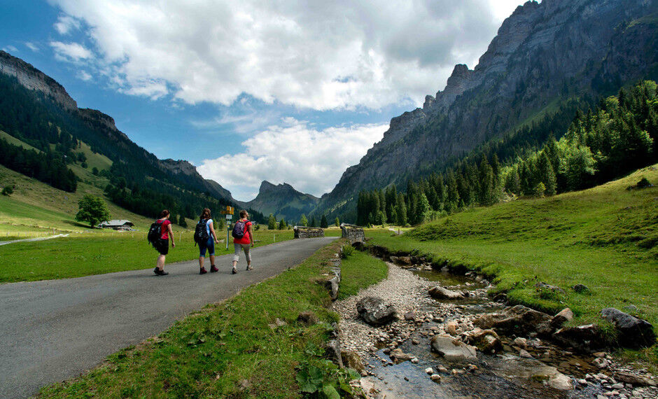
The route starts at the STI bus stop “Merligen Beatus” and heads into the village. Following the Grönbach, it then continues through the woodland along well-surfaced tarred tracks. On the track up to Gütsch, the gaps in the trees afford a splendid view of the Lake Thun region and the Niesen.
- Dificultad
-
medio
- Valoración
-
- Ruta
-
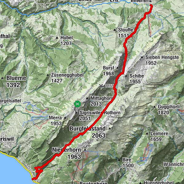
Restaurant BelAirMerligen (567 m)0,0 kmMunggetli0,5 kmGrön3,8 kmHinterstberg (1.370 m)8,2 kmOberhofenberg8,4 kmSäge14,8 kmGasthaus Säge14,8 km
- La mejor temporada
-
enefebmarabrmayjunjulagosepoctnovdic
- Punto álgido
- 1.669 m
- Punto final
-
Innereriz, Säge
- Perfil alto
-
 © outdooractive.com

-

-
AutorLa gira Through the tranquil Justis valley and over Sichle into Eriz es utilizado por outdooractive.com proporcionado.
GPS Downloads


Información general
Punto de avituallamiento
Fauna
Más circuitos por las regiones
-
Obwalden
2014
-
Thunersee
1055
-
Beatenberg
386


