- Breve descripción
-
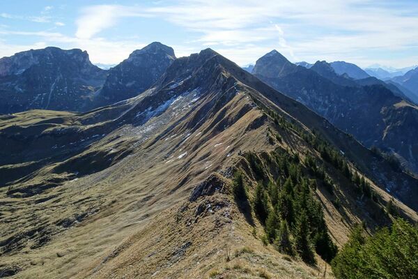
Bergwanderweg ab Bire. Wanderung aus dem üppig-grünen Saanenland dem Simnegrabe entlang zur aussichtsreichen Bire. Anschliessend leichte Bergwanderung über den Hugeligrat zum Rellerli: eine Höhenwanderung im wahrsten Sinne des Wortes! Weite Ausblicke über Täler und Dutzende von Vor- und Hochalpengipfeln. 2 km Hartbelag zu Beginn der Wanderung.
- Dificultad
-
medio
- Valoración
-
- Ruta
-
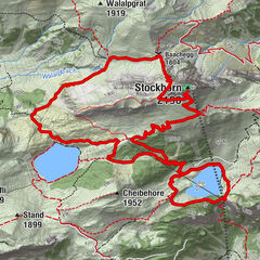
Schönried (1.231 m)Pizzeria da Corrado0,1 kmLa Nicchia0,2 kmSchönried (1.200 m)0,3 kmBire (1.789 m)5,8 kmRellerligrat (1.843 m)10,5 kmSchönried (1.200 m)14,7 kmLa Nicchia14,8 kmPizzeria da Corrado14,8 kmSchönried (1.231 m)15,0 km
- La mejor temporada
-
enefebmarabrmayjunjulagosepoctnovdic
- Punto álgido
- 1.859 m
- Punto final
-
Schönried
- Perfil alto
-
 © outdooractive.com
- Autor
-
La gira Über Hugeli- und Rellerligrat es utilizado por outdooractive.com proporcionado.
GPS Downloads


Información general
Punto de avituallamiento
Vistas panorámicas
Más circuitos por las regiones
-
Alpes Vaudoises
991
-
Destination Gstaad
740
-
Schönried
192