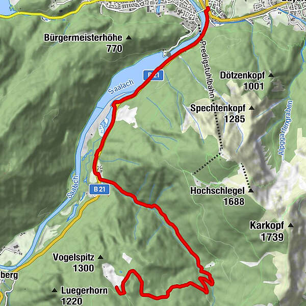
Datos del tour
9,68km
471
- 1.261m
745hm
23hm
01:45h
- Dificultad
-
medio
- Valoración
-
- Punto de salida
-
Wegezentrum 5: Kirchberger Bahnhof/Lattengebirge; Anton-Winkler-Straße nähe Nikolaikirche
- Ruta
-
Bad Reichenhall (473 m)
- La mejor temporada
-
enefebmarabrmayjunjulagosepoctnovdic
- Punto álgido
- 1.261 m

GPS Downloads


Calzadas
Asfalto
(10%)
Gravilla
(80%)
Bosque
Caminos de montaña
Rutas individuales
Trial
Tráfico
(10%)
Más circuitos por las regiones
-
Berchtesgadener Land
267
-
Bad Reichenhall
115