Donausteig Stage 1_N02 Obernzell - Niederranna "Between the Danube and the High plateau"

© WGD Donau Oberösterreich Tourismus GmbH/Weissenbrunner
© WGD Donau Oberösterreich Tourismus GmbH - WGD Weissenbrunner
© WGD Donau Oberösterreich Tourismus GmbH/Weissenbrunner

© WGD Donau Oberösterreich Tourismus GmbH/Weissenbrunner - Weissenbrunner

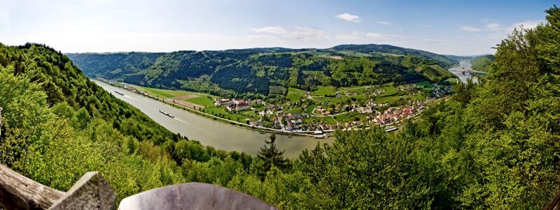
© Donauregion

- Breve descripción
-
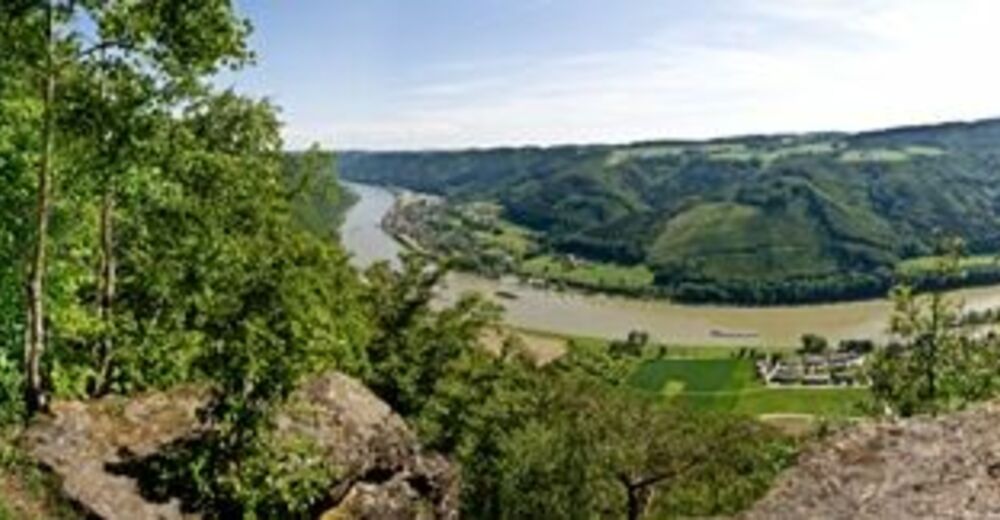
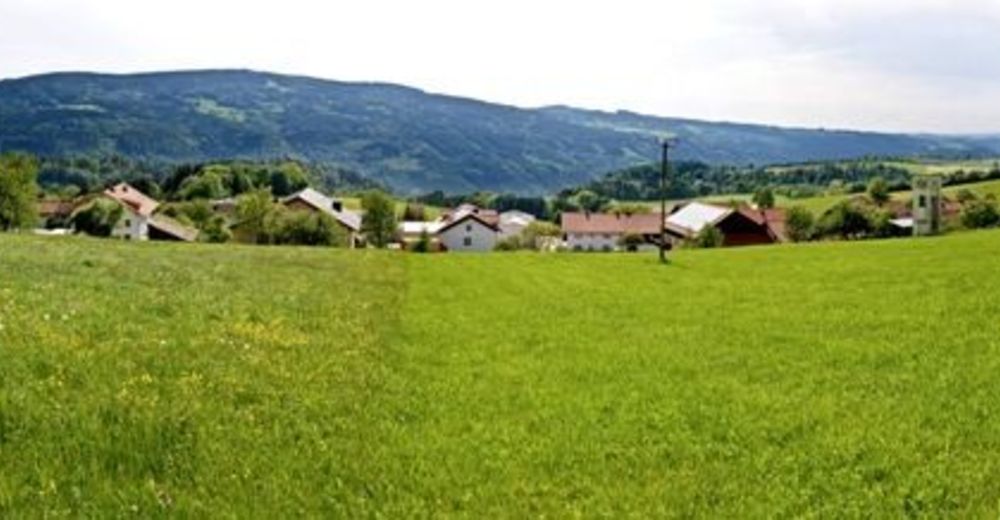
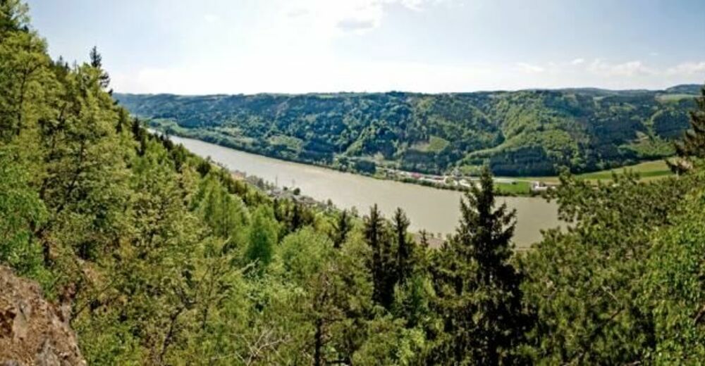
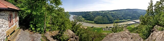
The Donausteig-simply fabulous! On this stage, we follow the forested Durchbruchstal (valley) of the upper Danube - partly along the mighty Danube river, partly above on the rural plateau. We discover Obernzell as a jewel of the Danube, the highly demanded Passau porcelain clay, the frontier of upper bavaria, the natural jewel called the donauleiten, the importance of fishing in the middle ages...
- Dificultad
-
difícil
- Valoración
-
- Ruta
-
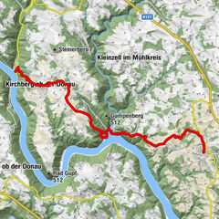
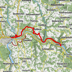
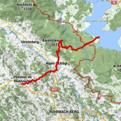
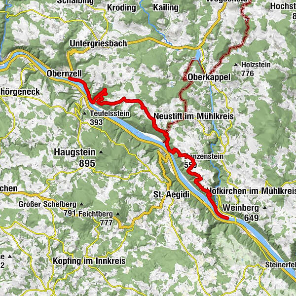
ObernzellKasten1,8 kmKohlbachmühle2,5 kmTeufelsloch3,9 kmEndsfelden6,3 kmStollberg7,2 kmHitzing7,5 kmKrottenthal9,4 kmEbenstein (586 m)11,2 kmAussicht am Ebenstein11,2 kmRiedl11,8 kmEngelhartszell13,8 kmPenzenstein (550 m)15,2 kmPühret16,5 kmPühretstein17,4 kmDorf18,5 kmArme Sünder Kapelle18,8 kmRannariedl20,7 kmNiederranna23,2 kmSchiffsanlegestelle23,2 km
- La mejor temporada
-
enefebmarabrmayjunjulagosepoctnovdic
- Punto álgido
- 631 m
- Punto final
-
Niederranna - The Donausteig-starting place 'Niederrana' is located directly next to the ship dock 'Niederranna' (South of the Draxler Inn) Only reachable by foot!
- Perfil alto
-
 © outdooractive.com


- Autor
-
La gira Donausteig Stage 1_N02 Obernzell - Niederranna "Between the Danube and the High plateau" es utilizado por outdooractive.com proporcionado.
GPS Downloads


Información general
Punto de avituallamiento
Cultural/Histórico
Flora
Fauna
Vistas panorámicas
Más circuitos por las regiones