© Bühl-Bühlertal-Ottersweier - Tourist-Info Bühl
- Breve descripción
-
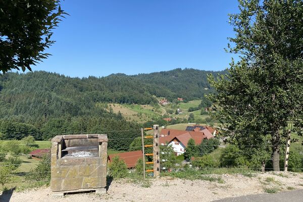
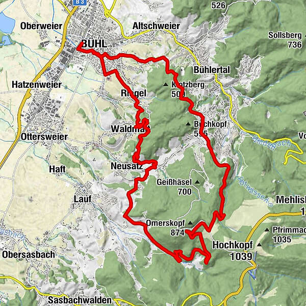
Mittelschwierige Tour durch Reben und Wälder
- Dificultad
-
medio
- Valoración
-
- Ruta
-
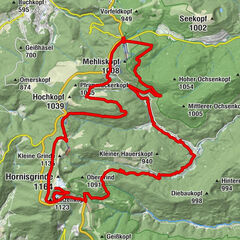
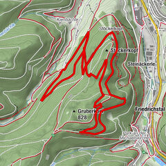
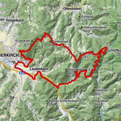
Bühl (138 m)0,7 kmRiegel3,0 kmRebstock3,4 kmWaldmatt4,7 kmPanoramarestaurant Burg Windeck5,5 kmVesperstube Pferdestall5,6 kmSchugshof6,5 kmNeusatz7,8 kmS'Narrebrünnele9,5 kmKirchbühl9,6 kmDrei-Röhren Brunnen10,0 kmGebersberg10,0 kmLochwald11,8 kmGlashütte14,9 kmBerggasthof Immenstein23,1 kmSchwarzwasen23,9 kmBuchkopf24,5 kmSt. Maria29,1 kmKappelwindeck29,2 kmBühl (138 m)30,4 km
- La mejor temporada
-
enefebmarabrmayjunjulagosepoctnovdic
- Punto álgido
- 816 m
- Punto final
-
Bahnhof Bühl
- Perfil alto
-
 © outdooractive.com

- Autor
-
La gira Omerskopf-Tour es utilizado por outdooractive.com proporcionado.
GPS Downloads


Información general
Punto de avituallamiento
Cultural/Histórico
Vistas panorámicas
Más circuitos por las regiones