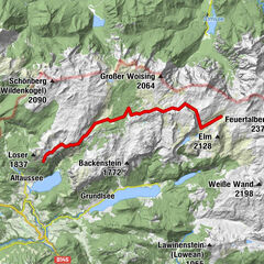
Invierno
Verano
El tiempo
Webcams
Alojamientos
Excursiones
Historial de búsqueda
Sugerencias de búsqueda
No se han encontrado resultados
Buscar en
long-distance walking trail
Inicio
Verano Österreich
Steiermark
Ausseerland - Salzkammergut
Altaussee - Loser
Excursiones
long-distance walking trail
Región
Alojamientos
El tiempo
Webcams
Consejos para el tiempo libre
Excursiones
Deporte
Lagos
Fotos
Vídeos
Proveedor de Deportes
Foro
Estación de esquí
long-distance walking trail
Altaussee - Loser
Mapa
mostrar
ocultar
Filtro de circuitos
Tipo de excursión
(Todos)
Senderismo (268)
long-distance walking trail (9)
Sendero temático (7)
Mountain hiking (6)
Camino de peregrinación (3)
Walking (1)
Búsqueda de texto completo
Nivel
mín.
1 fácil
2 moderadamente
3 mediana dificultad
4 dificultad alta
5 muy difícil
6 extremo
máx.
1 fácil
2 moderadamente
3 mediana dificultad
4 dificultad alta
5 muy difícil
6 extremo
Técnica
mín.
1 fácil
2 moderadamente
3 mediana dificultad
4 dificultad alta
5 muy difícil
6 extremo
máx.
1 fácil
2 moderadamente
3 mediana dificultad
4 dificultad alta
5 muy difícil
6 extremo
Longitud (km)
Metros de altura
otros filtros
Buscar
Posponer
9 Excursiones.
ordenado por
Relevanz
Relevancia
längste Distanz
kürzeste Distanz
duración máxima
duración mínima
metros más verticales
menos metros verticales
alto estado
baja condición
alta tecnología
baja tecnología
Nombre A-Z
Nombre Z-A
01 Nordalpenweg, 26. Etappe: Loserhütte - Bad Goisern
medio
3,0
21,03
km
07:00
h
622
hm
497 - 1.503
m
Técnica
Nivel
01 Nordalpenweg: Loserhütte - Bad Goisern
medio
19,03
km
08:30
h
923
hm
746 - 1.488
m
Técnica
Nivel
01 Nordalpenweg, 25. Etappe: Pühringerhütte - Loserhütte
medio
19,23
km
10:00
h
681
hm
1.331 - 1.879
m
Técnica
Nivel
01 Nordalpenweg: Von der Pühringerhütte zur Loserhütte
medio
18,25
km
08:00
h
948
hm
1.332 - 1.875
m
Técnica
Nivel
SalzAlpenSteig: Etappe 18: Bad Goisern - Obertraun
medio
2,0
13,75
km
05:45
h
92
hm
496 - 564
m
Técnica
Nivel
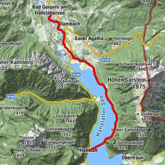
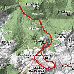
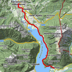
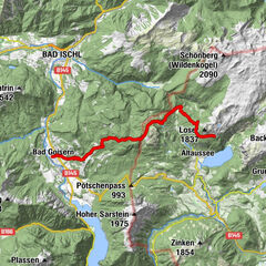
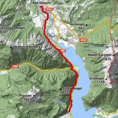
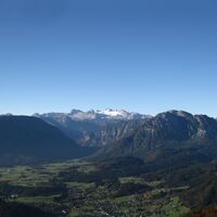
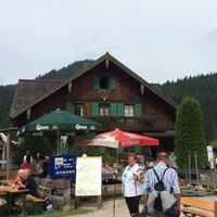
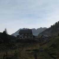
Hallstatt - Bad Goisern | Dachstein Circular Hiking Trail: Stage 07
fácil
11,96
km
03:00
h
19
hm
497 - 527
m
Técnica
Nivel
nordalpenweg01_E25
medio
18,3
km
04:38
h
655
hm
497 - 1.499
m
nordalpenweg01_E24
medio
18,6
km
04:40
h
885
hm
1.332 - 1.877
m
01 Nordalpenweg, 27. Etappe: Bad Goisern - Hallstatt
fácil
12,55
km
04:15
h
280
hm
497 - 659
m
Técnica
Nivel
Tous según tipos
Senderismo
Bike
Invierno
Alpino
Running
Otros
Agua
Senderismo
long-distance walking trail
Sendero temático
Mountain hiking
Camino de peregrinación
Walking
Touren nach Regionen
Ausseerland - Salzkammergut
96
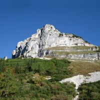
Gipfeltouren in der Region
Hohe Schrott (1.839 m)
4
Hoher Sarstein (1.975 m)
15
Schönberg (Wildenkogel) (2.090 m)
4
Rinnerkogel (Augstkogel) (2.012 m)
7
Loser (1.837 m)
15
Kampl (1.685 m)
5
Sandling (1.717 m)
7
Wehrkogel (2.008 m)
4
Hochanger (1.837 m)
10
Predigstuhl (1.278 m)
11
Excursiones opcionales por los alrededores
Großer Schönberg/Wildenkogel
medio
Senderismo
17,58
km |
1663
hm |
06:48
h
Altausseer Seerundweg
Senderismo
6,34
km |
61
hm |
02:30
h
Trisselwand
medio
Senderismo
4,39
km |
820
hm |
04:00
h
Hütteneckalm-EwigeWand-Runde von Bad Goisern
fácil
Mountainbike
27,08
km |
912
hm |
01:30
h
Vecinos
Altaussee
Bad Aussee
Grundlsee
Krippenstein / Obertraun
Obertraun
Regiones favoritas
Graz - Stadt
Bad Aussee
Deutschlandsberg
Weiz
Leoben
Leibnitz
Kapfenberg
Liezen
Mariazell
Bad Mitterndorf
Solarstadt Gleisdorf
Bruck an der Mur
Eibiswald
Knittelfeld
Hartberg
Admont
Feldbach
Trofaiach
Eisenerz
Gröbming
Sorteo
Produkt-Paket für die ganze Familie
Primavera XXL-Gewinnspiel
No se han encontrado entradas.
La búsqueda no está disponible actualmente.
Afine su búsqueda.
Resultados de la búsqueda local
(<= 25km)
Más resultados
(> 25km)
%count% Resultados de búsqueda
%name%
%type%
%elevation%
%population%
%lpButton%